fbpx

Shenshan BioCity

South China University of Technology School of Environment and Energy / Shanwei, China

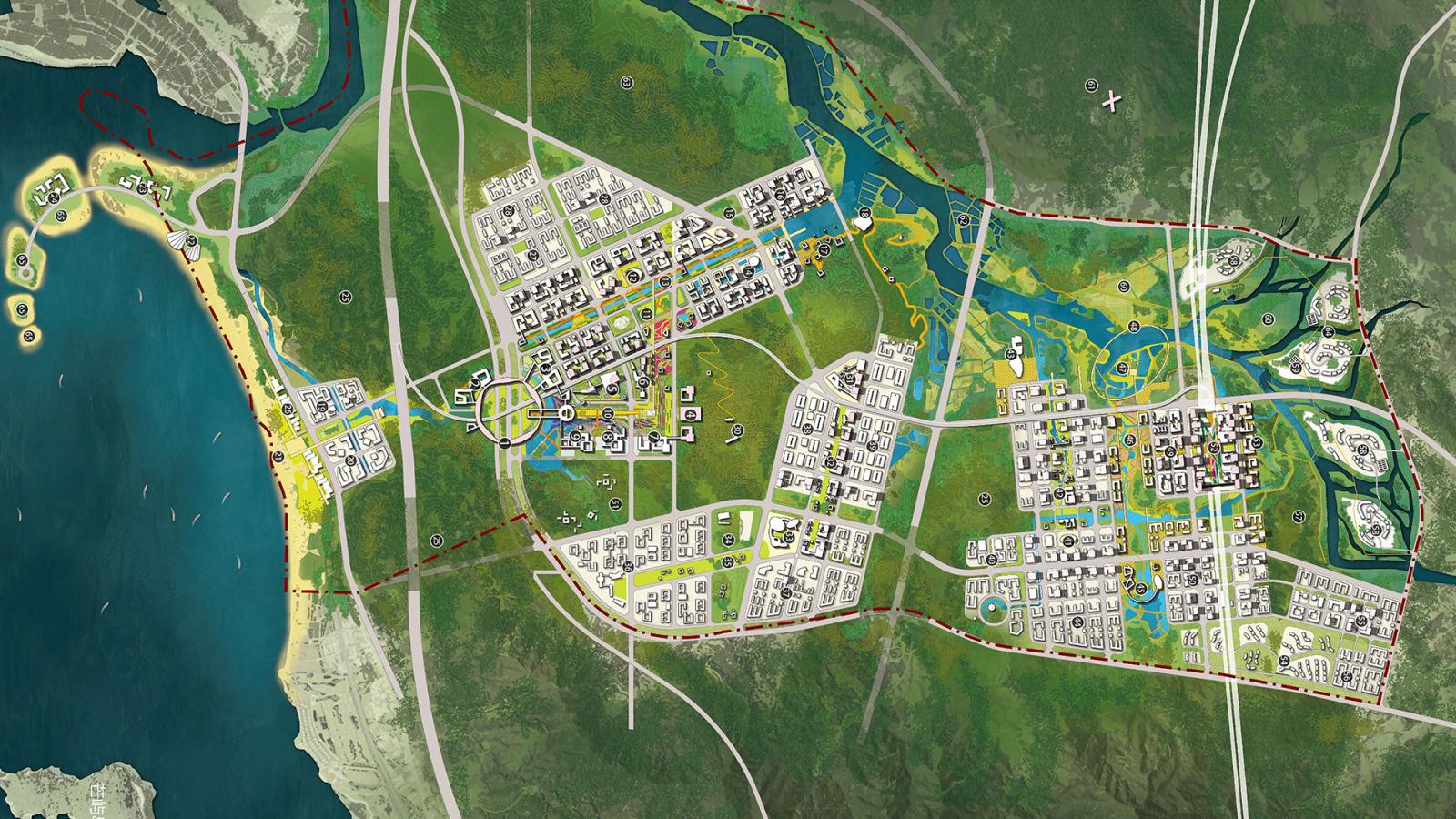
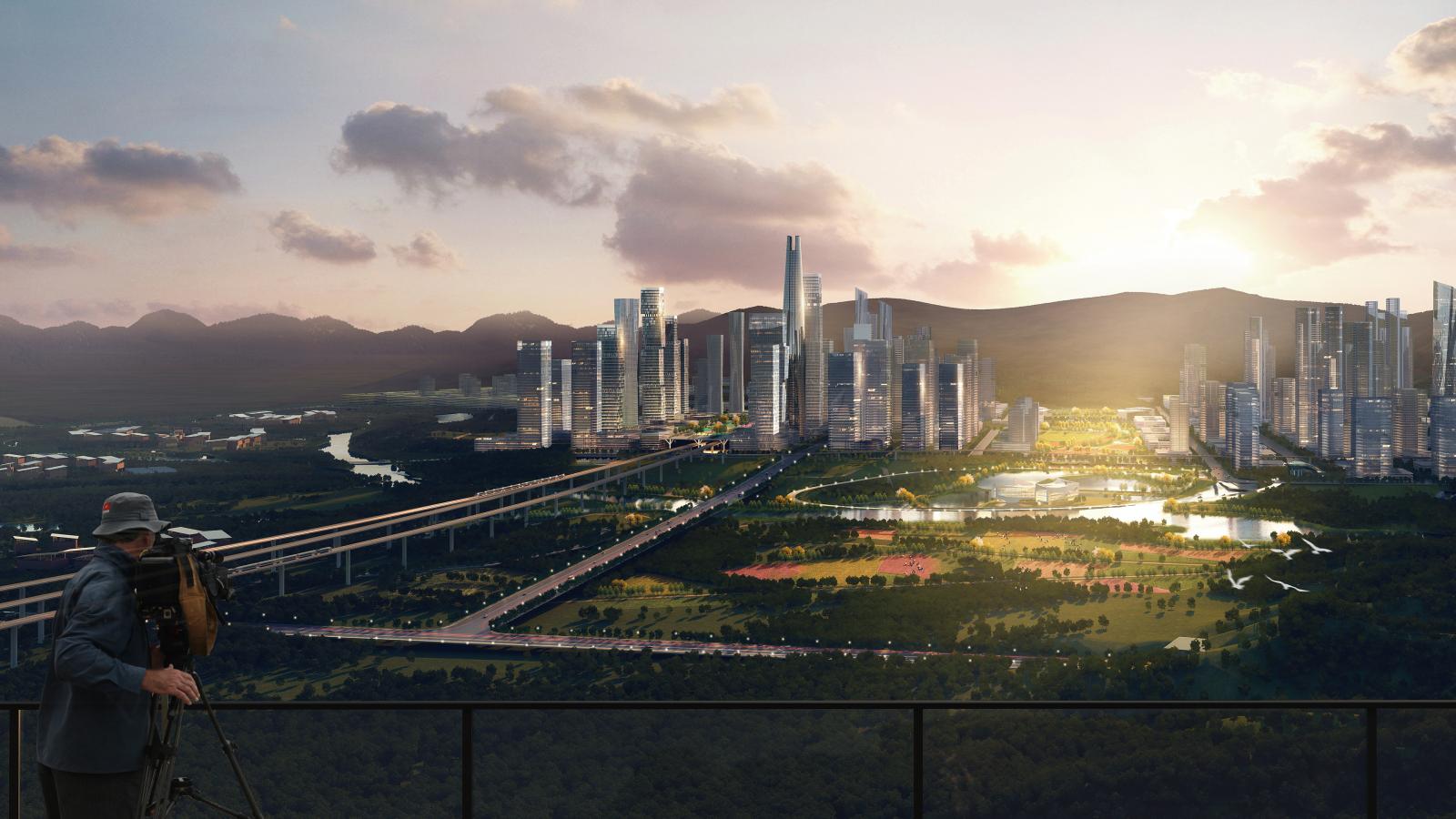
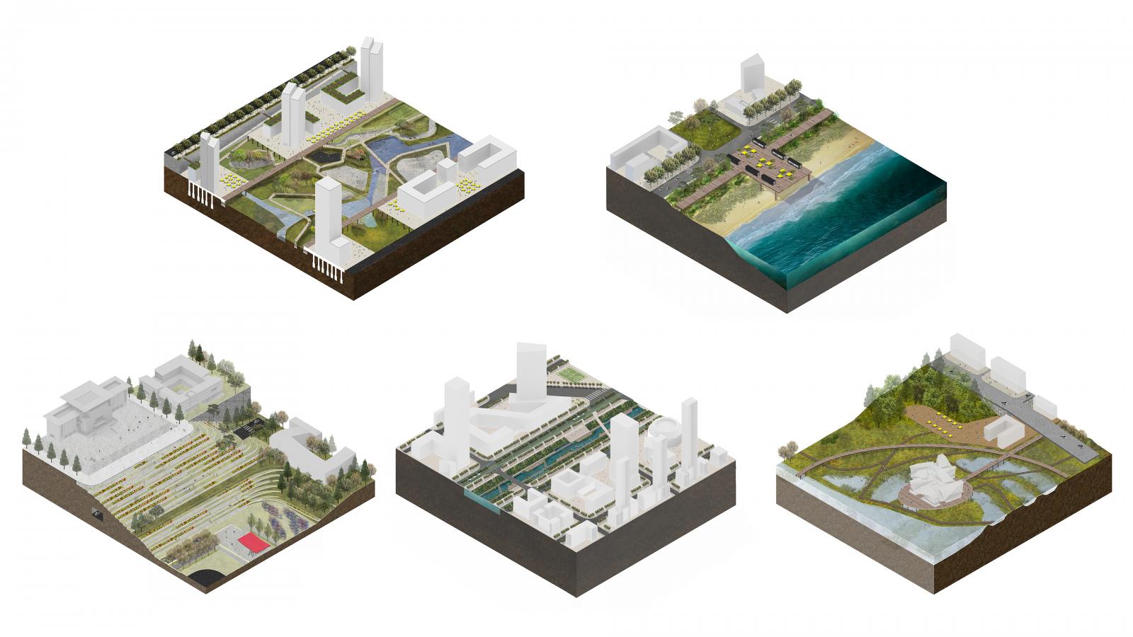
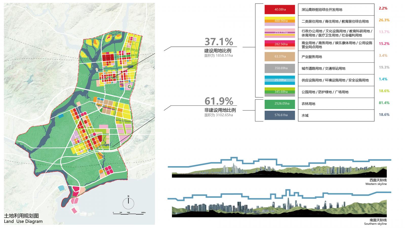
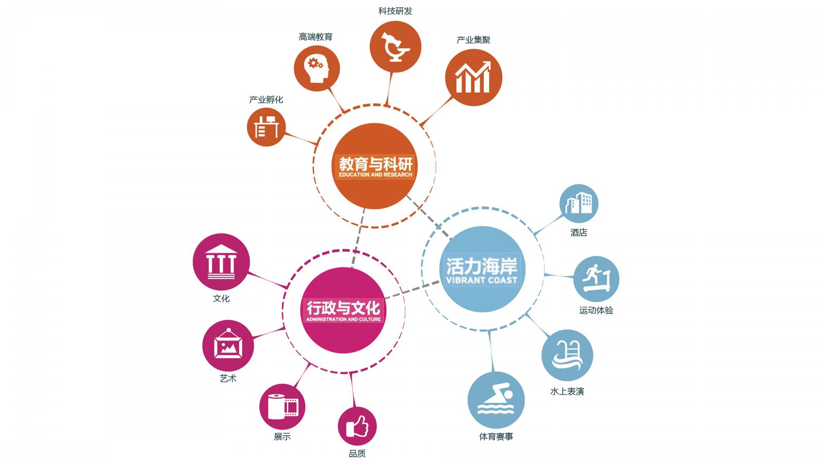
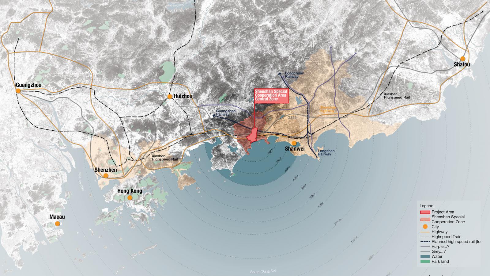
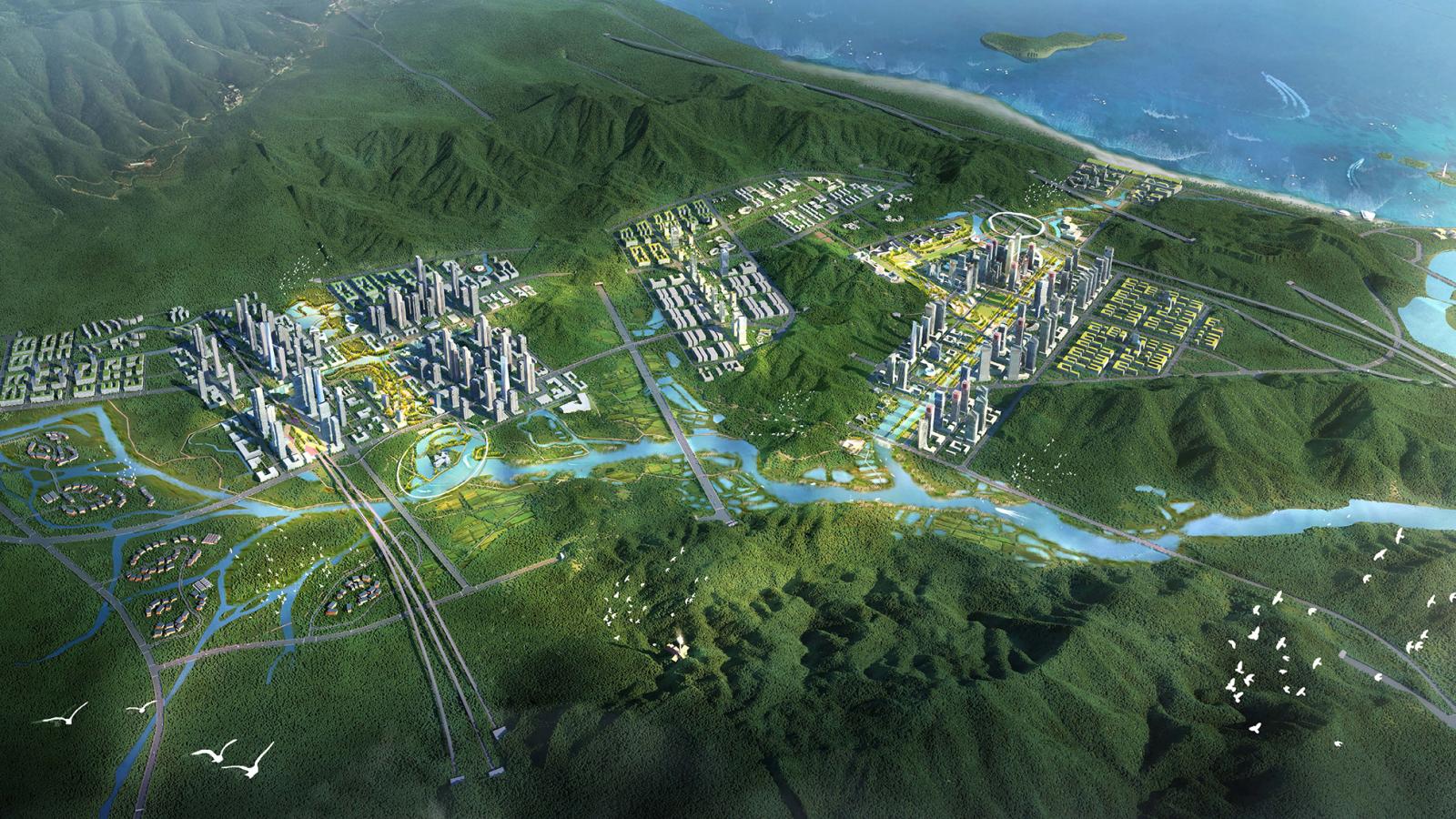
The Shenshan cooperation zone will be a new specialised district for smart technology, set to become a global leader in A.I by 2030. Housing 1.5 million people on a 145km2 coastal site to the east of Shenzhen, our design vision was to create a ‘living lab’ where hi-tech business and the natural environment co-exist in a metropolis of islands along the Chishi River. The BioUrbanism approach combines innovation in technology, environmental ecology and wellbeing to foster a city of the future.

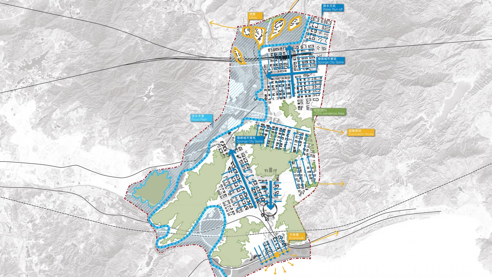
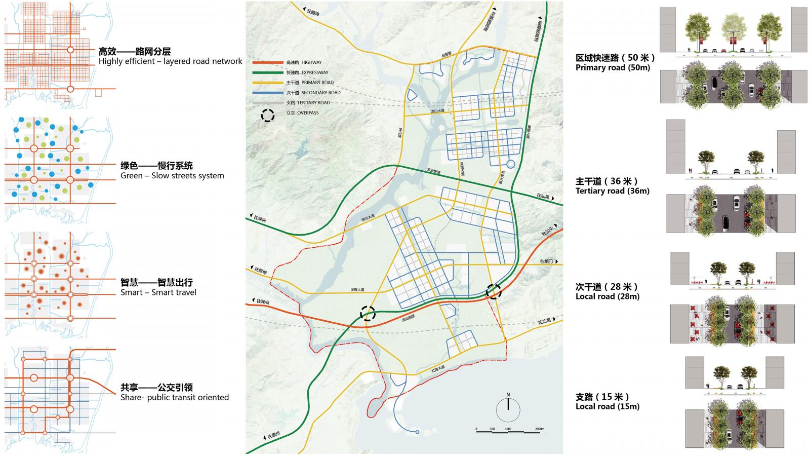
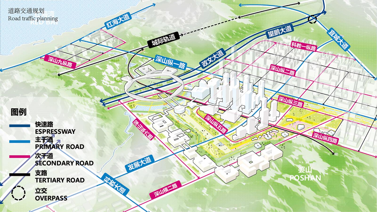
Development is located on elevated ‘urban islands’ rising above the flood zone. Existing historic waterways, agricultural lands and irrigation networks are retained to preserve ecological habitat and food production whilst acting as a sponge to filter storm water runoff from the urban areas. Comprising 12 distinctive districts Shenshan is planned as a waterfront ‘BioCity’ that embraces its mountainous coastal environment, rich agricultural plains and river setting. Integrated multi-modal transport infrastructure ensures a 30 minute city that accommodates modern mobility needs, creating a vibrant lifestyle for its citizens.

Site Area

5000 ha

Services

  • Competition
  • Regional Planning
  • Research
  • Urban Design Framework
  • Visual Analysis
  • Waterfront

Collaborators

  • Shenzhen Urban Planning
  • Land & Resources Commission of Shenzhen Municipality
  • Polaris Gis Ltd
  • APG Architecture
Black and white portrait of Ann Deng, a woman with short dark hair smiling at the camera. She is wearing a short-sleeved, fluffy light-colored sweater and a delicate necklace with a small pendant. She stands against a plain background.
Talk to Ann Deng about Shenshan BioCity
Get In Touch
A detailed map of the BioCity urban development plan highlights various residential and commercial buildings, parks, and green spaces. Major roads and highways are outlined, with a coastline on the left and a river meandering near the center. An airport is visible in the upper right of Shenshan.
A detailed map outlines an urban planning area with different zones marked in various colors. Key features include residential areas, greenery, roads, and waterways. Labels indicate specific sectors of Shenshan BioCity. Overlaid lines represent transit routes and boundaries.
A person taking a photograph of a futuristic cityscape at sunset. The skyline of Shenshan is filled with tall buildings and intertwined highways, surrounded by lush greenery, rivers, and distant mountains under a partly cloudy sky, embodying the essence of BioCity.
A detailed urban planning map of Shenshan BioCity shows a highly efficient layered road network with integrated green and smart travel systems. Diagrams depict primary, tertiary, local, and transit-oriented roads with accompanying cross-sections and labeled distances. Text is in Chinese.
Five architectural models showcasing different urban designs. Each model highlights various elements such as buildings, greenery, water features, roads, and artistic layouts. The bottom right model includes a body of water and surrounding pathways inspired by BioCity concepts integrating biotechnology innovations.
Land use diagram of Shenshan BioCity depicting a mix of zones including residential, commercial, industrial, and green spaces. Graphs and text detail allocation percentages: 37.1% unbuilt and 61.9% built area. Cross-sections show varying building heights within the terrain's elevation profile.
A circular infographic showcases policy support for planning and financial aid in BioCity, with text in Chinese. The left semi-circle is in red, detailing various regulations from 2011 to 2018. The right semicircle is in green, explaining six funding support measures and their impacts on biotech advancement.
A detailed map illustrating road traffic planning in BioCity. It features various roads categorized into different types: expressway, primary road, secondary road, and tertiary road. Overpasses and key landmarks are also marked. Labels and text are in Chinese to cater to the Shenshan area.
A stylized diagram illustrating interconnected sectors, featuring circles labeled with icons and Mandarin text representing 'Education and Research,' 'Administrative and Culture,' and 'Vibrant Coast.' Each main circle branches into smaller circles with related subcategories, highlighting Shenshan's BioCity.
A detailed map showcases the cities and infrastructure around the Shenzhen Special Economic Zone in China, including the innovative Shenshan BioCity. It highlights highways, high-speed railways, and ports in areas like Hong Kong, Macau, and Guangzhou, with a legend indicating different zones and facilities.
A detailed aerial view of Shenshan BioCity, an extensive, futuristic biohub integrated with lush greenery. Skyscrapers and residential buildings are dispersed among verdant hills, connected by roads, bridges, and waterways. The city is bordered by mountains and a body of water.

More Projects