fbpx

Parramatta Road

Parramatta Road / Sydney, Australia

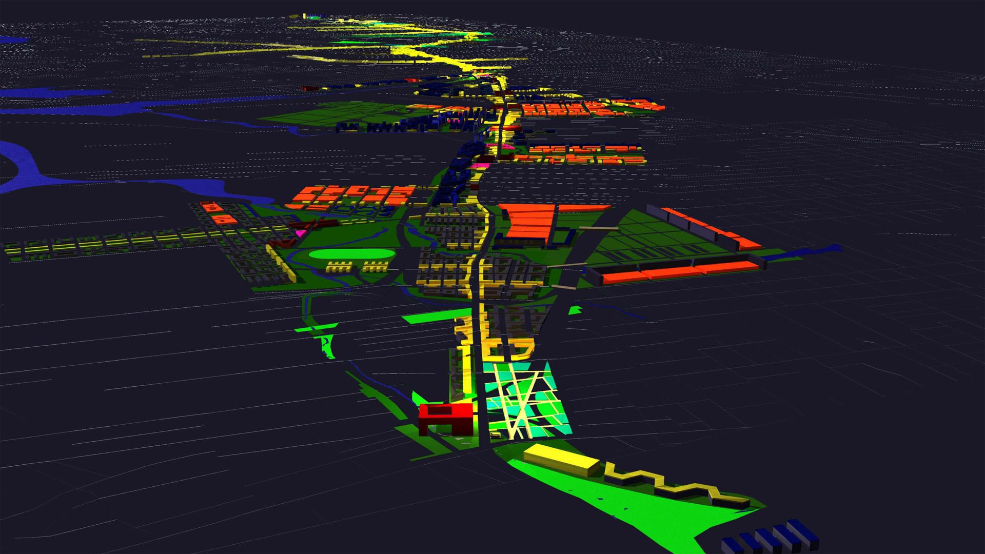
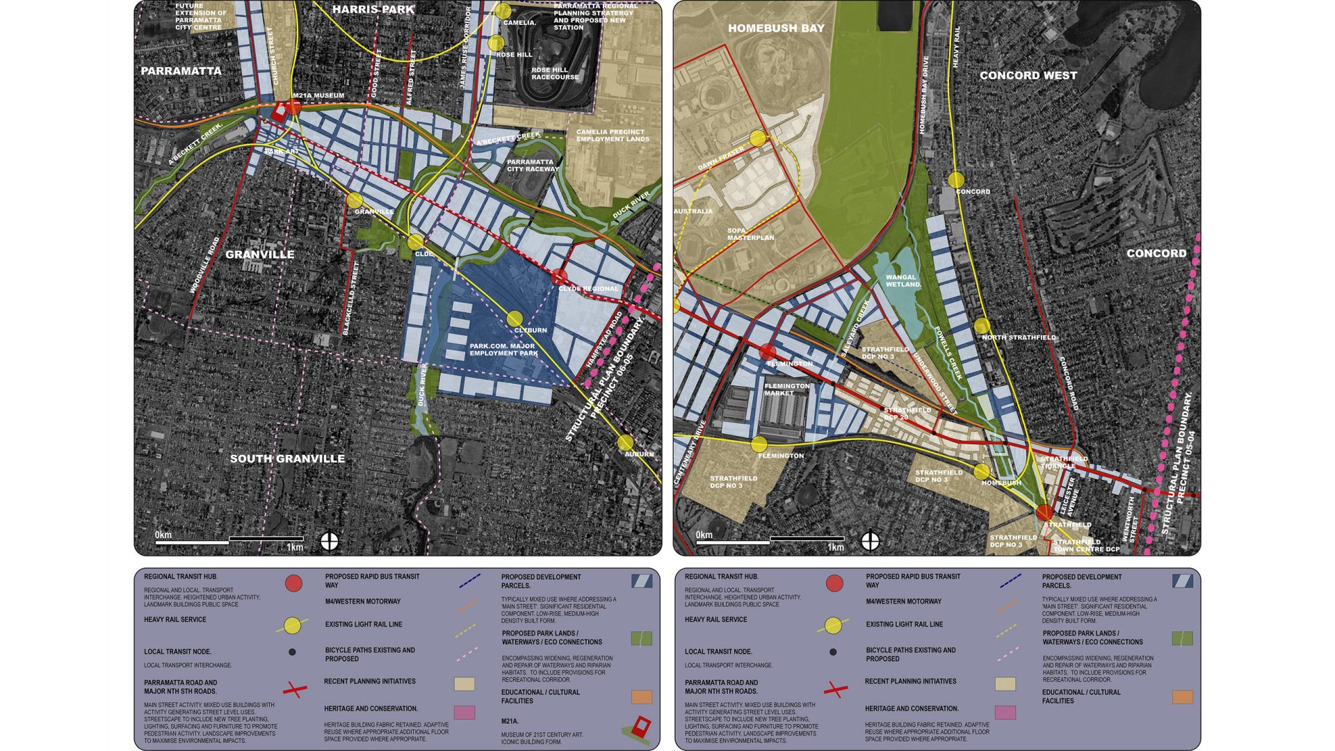
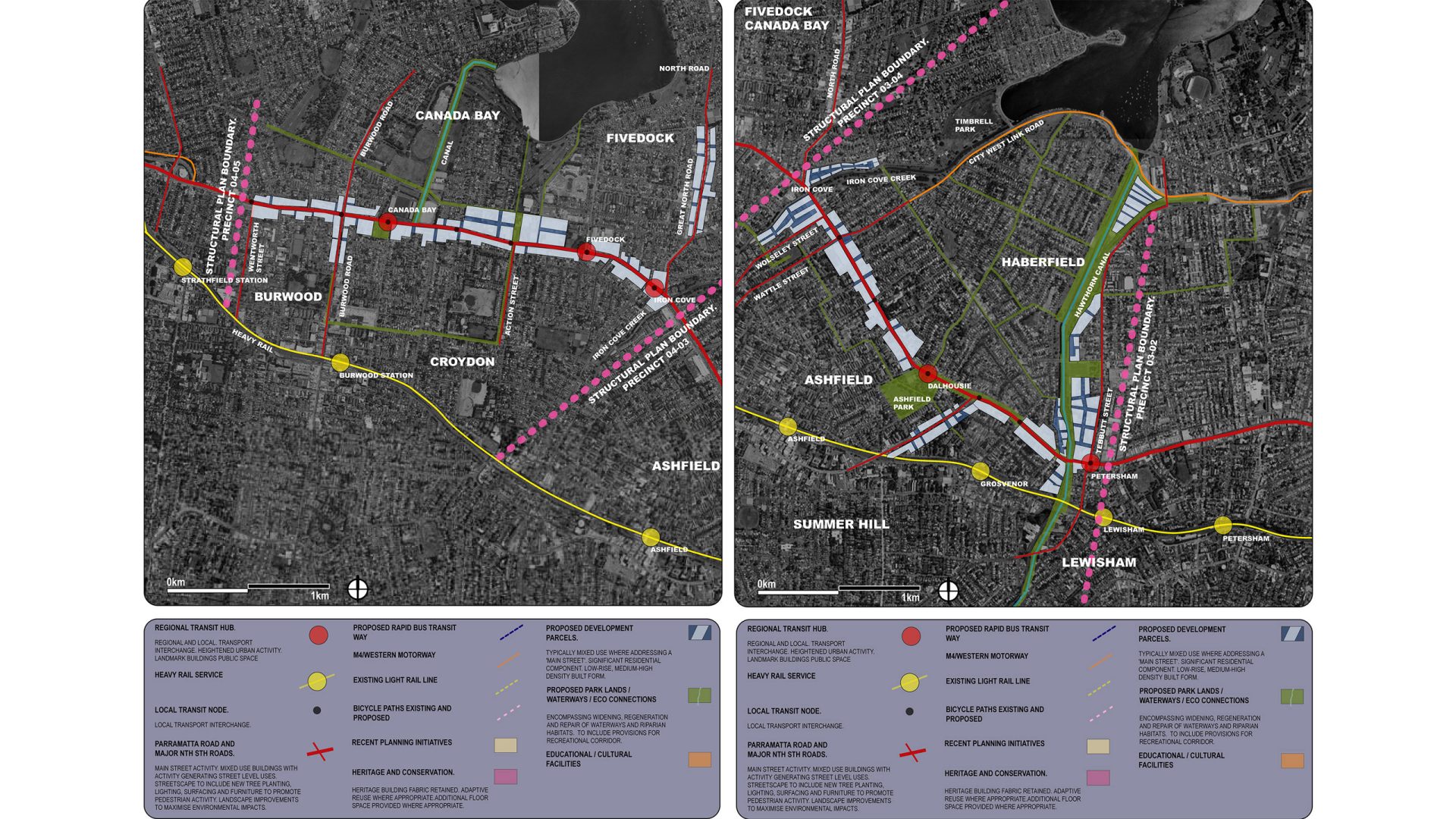
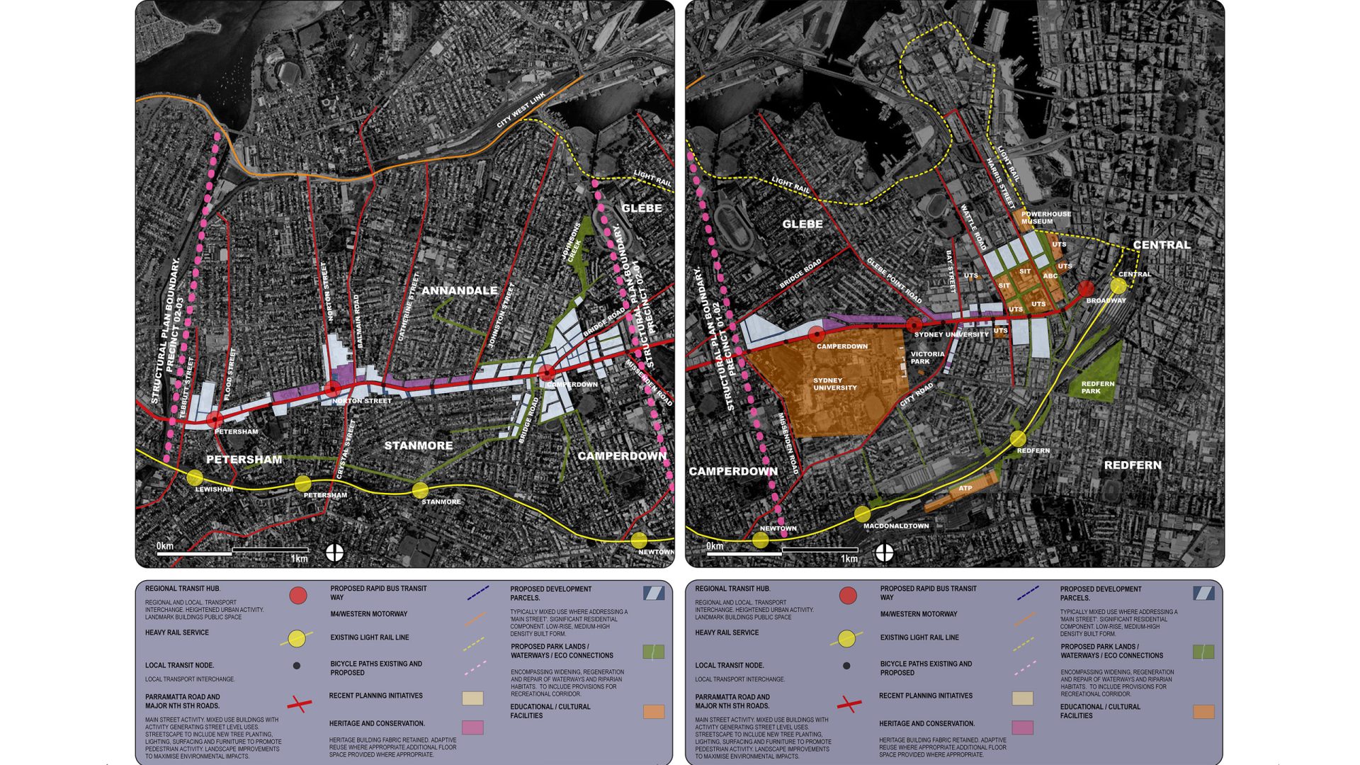
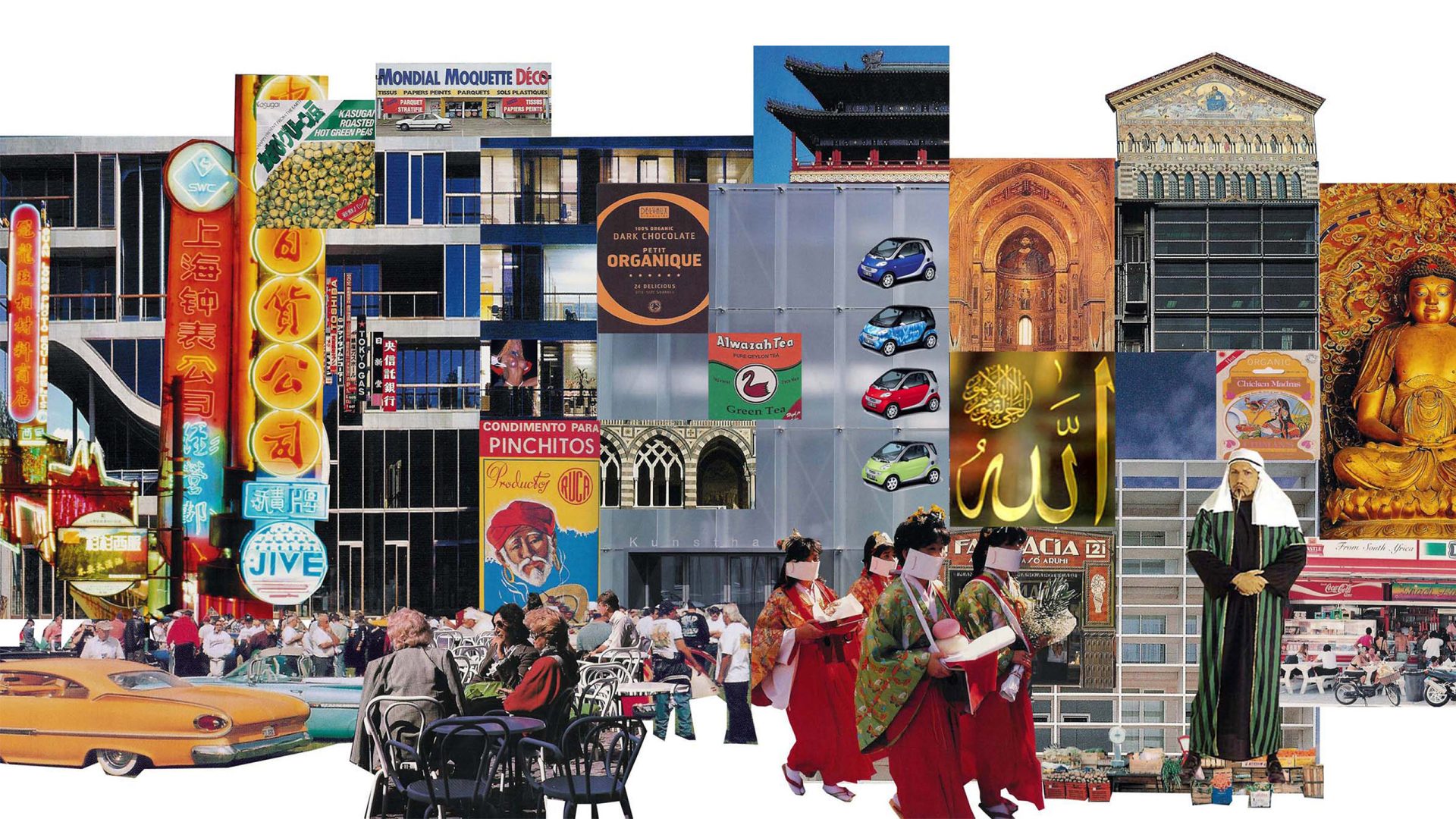
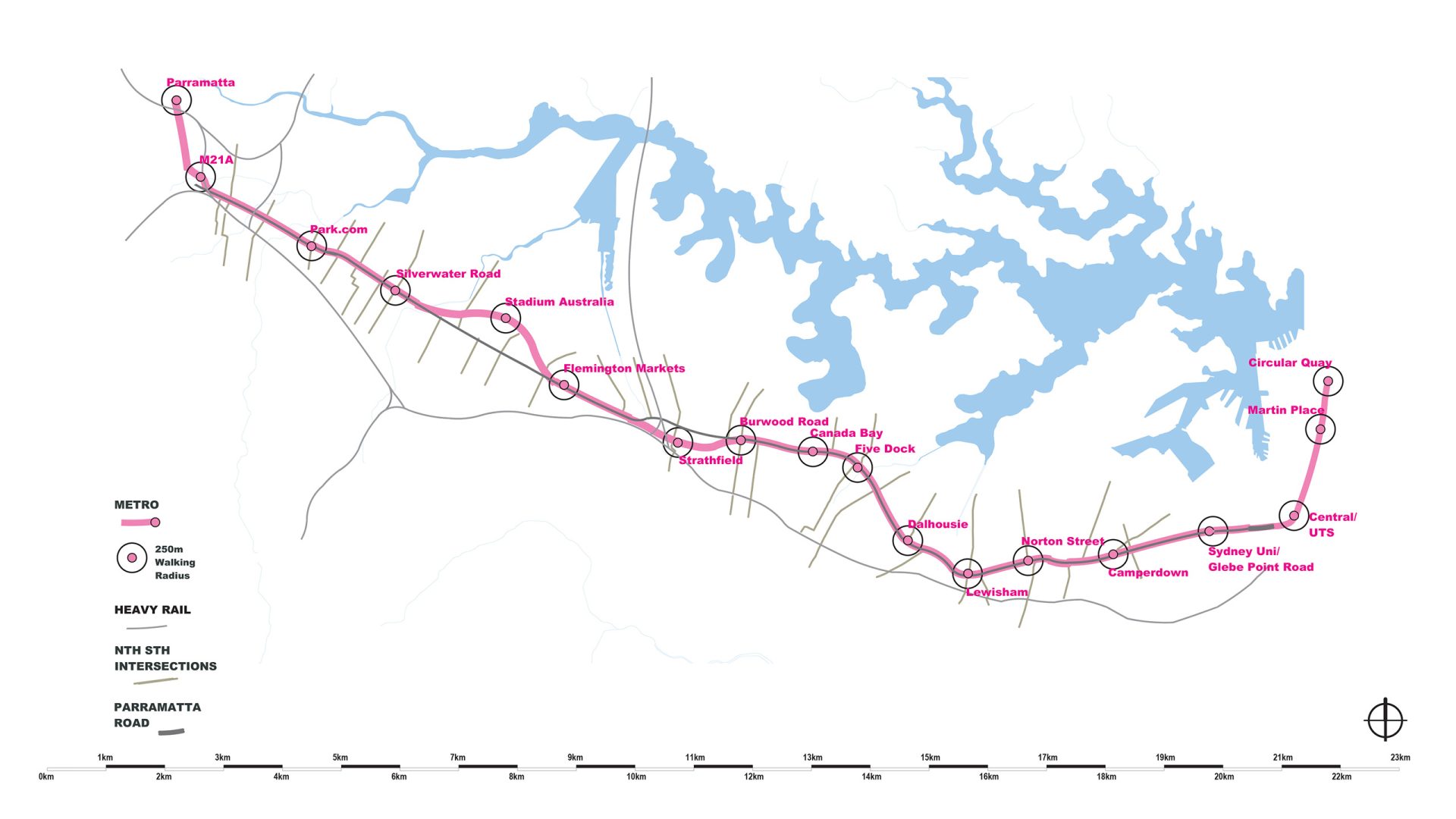
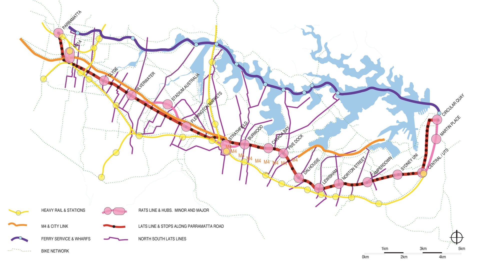
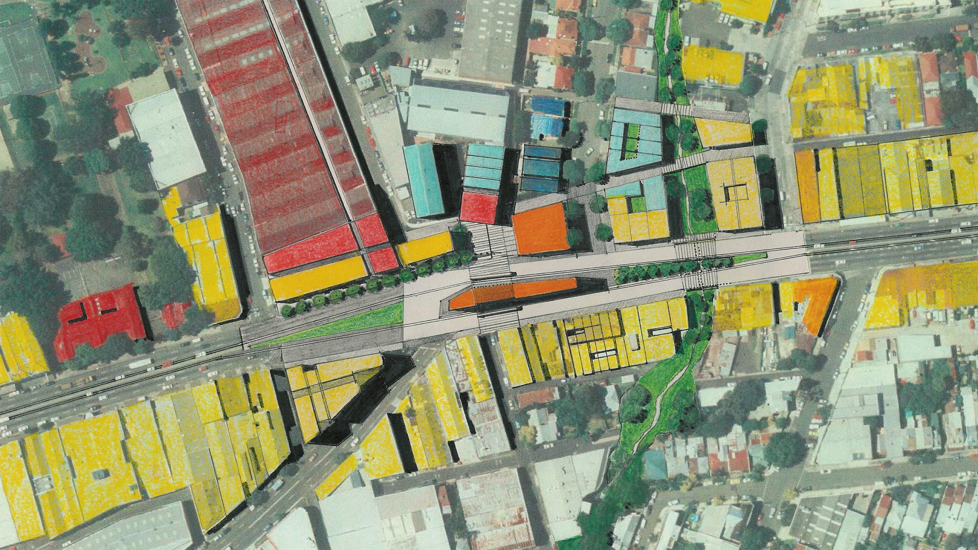
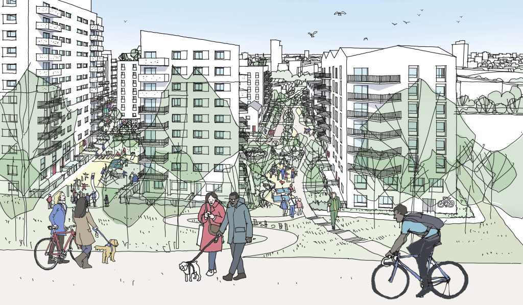
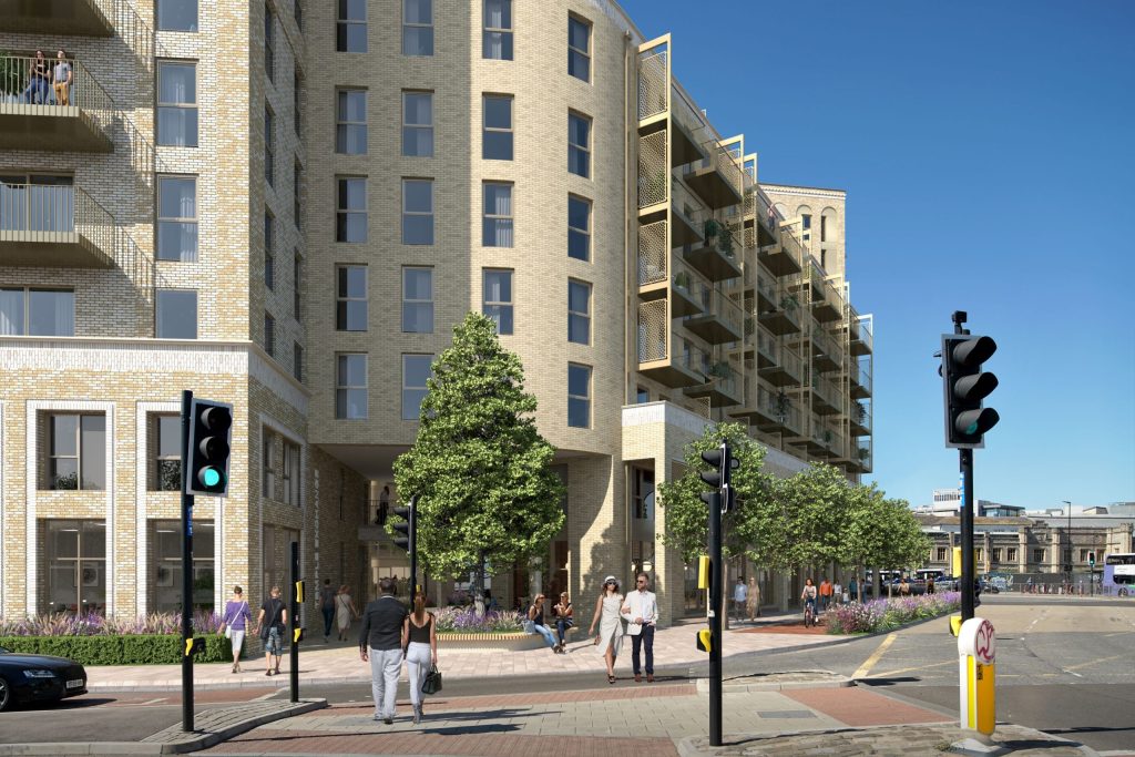
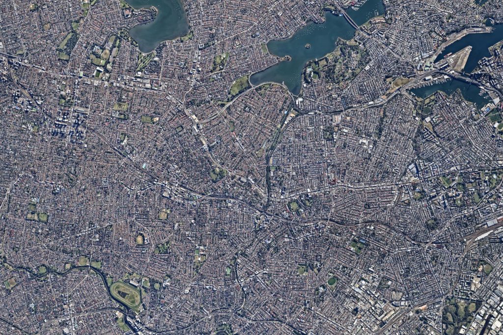
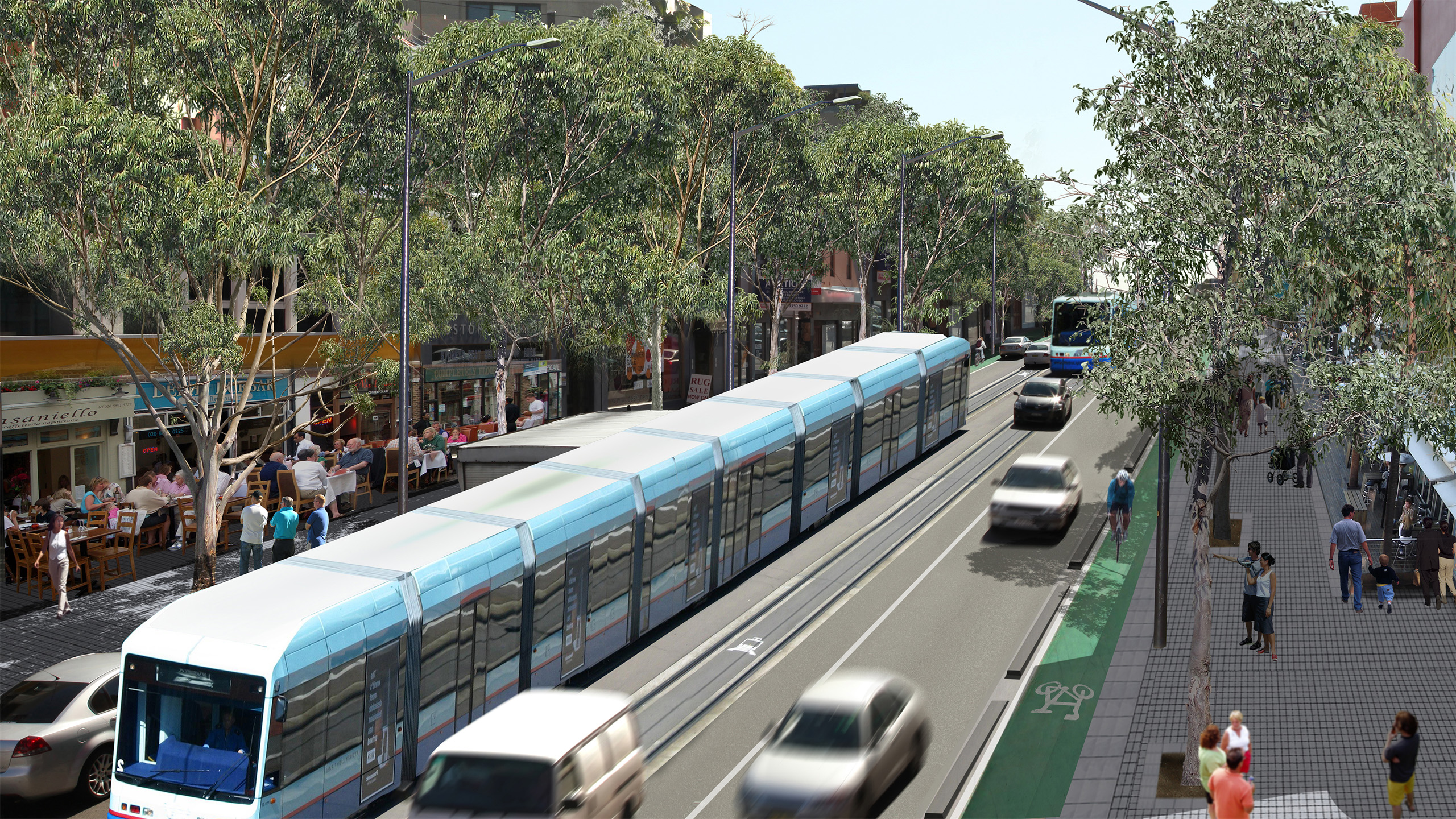
Not since the international competition for Canberra, has Australia undertaken such an ambitious urban design project. The competition which short listed MVRDV and Ken Yeang was won by SydneyCENTRAL. Our team planned extensive renewal beyond the 23km Parramatta Road corridor presently choked by 80,000 vehicles each day, proposing Sydney mature from its ‘Harbour centric’ view to embrace the west as a major sustainable growth area. A blueprint for the revitalisation of the decaying 200 year old thoroughfare between Sydney city and Parramatta CBD was prepared. The project will deliver outcomes in regional planning, urban design, business precinct development, employment, public transport, traffic management, environmental quality, and partnerships between spheres of government, business and community. Can Sydney be more than the harbour?

Site Area

1.15 ha

Services

  • Competition
  • Landscape Master Plan
  • Streetscape
  • Urban Design Framework

Scope

  • Miscellaneous Services
  • Draft Concepts
  • Draft Master Plan

Collaborators

  • TTM Consulting
  • Stanisic Architects
  • CHROFI
  • King & Campbell Pty Ltd
  • HillPDA Consulting
  • Knox City Council
Black-and-white portrait of Philip Coxall, an older man with curly, white hair and a beard. He is wearing a long-sleeved, black shirt and is looking directly at the camera with a neutral expression. The background is plain and light colored.
Talk to Philip Coxall about Parramatta Road
Get In Touch
A nighttime 3D model of an urban area showcases a bright yellow main road, reminiscent of Parramatta Road, running through the center. Various blocks and buildings are highlighted in green, orange, and red representing different zones or districts against a dark background.
A dual-panel map showcasing urban planning details for Parramatta, Granville, Homebush Bay, and Concord West areas. The legend at the bottom includes symbols for existing transit routes, proposed changes along Parramatta Road, local roads, and landmarks amid a grey satellite background.
A two-part map shows urban areas with color-coded paths indicating different routes for bicycling and walking, including Parramatta Road. Key landmarks, streets, and transport links are marked. A legend explains route types, amenities, and transport connections. Distinct areas are labeled.
Two adjacent maps detail transportation and infrastructure plans for the Parramatta urban area. Color-coded lines represent various routes and project stages. Legends and symbols at the bottom denote different aspects, such as roads, transit lines, and zones for development or preservation.
A 3D-rendered urban landscape inspired by Parramatta Road, showcasing a mix of colorful geometric buildings and structures. The scene features streets lined with trees, intersecting walkways, and various blocky buildings in shades of blue, red, and beige.
A black and white line drawing depicts a bustling Parramatta Road with historic and modern buildings. Key landmarks include buildings with domes and spires, a cylindrical structure, and a tower with "JUS" signage. There are stylized green trees lining the street.
A modern light rail train travels down a tree-lined city street, flanked by moving cars on Parramatta Road and a dedicated bike lane. Pedestrians walk on wide sidewalks, with outdoor dining on the left. The scene is vibrant and sunny, reflecting urban public transportation and community life.
A busy marketplace features people shopping for fruits, vegetables, and various items along Parramatta Road. In the background, an ornate traditional Chinese gate is prominently displayed, while four people in traditional attire engage near the gate, blending cultural elements.
A colorful collage of various global landmarks, cultural elements, and people. It features neon signs, traditional and modern buildings along Parramatta Road, religious symbols, cars, diverse individuals in traditional attire, and market scenes, representing a mix of cultures and eras.
Illustration of a modern building labeled "MCA" with large glass areas. A road with cars leads to the entrance in Parramatta. A person in acrobatic attire swings from the top of the building. To the right, there's an outlined piece of machinery emitting flames.
Abstract image depicting a map with various colored lines running diagonally across a dark background. Blue lines represent a river system, while red, yellow, and purple lines symbolize roads or routes intersecting through the area, with one prominent red line indicating Parramatta Road.
Map of the Sydney Metro West line showing stations from Westmead to Hunter Street. The map highlights metro and heavy rail lines, walking radii around stations, and notable intersecting roads like Parramatta Road. The route is depicted in pink, alongside a blue water body and grey land areas.
A detailed transportation map depicts various transit lines and connections in a region. Key features include heavy rail stations, major hubs, ferry services, city links, Parramatta Road stops, north-south lines, and bike networks.
A detailed aerial view of an urban area highlighting a transportation corridor along Parramatta Road. Buildings are color-coded in red, orange, yellow, and green. Streets and intersections are clearly visible, with a central segment featuring pathways and green spaces.

More Projects