fbpx

Inner West Blue-Green Grid Strategy

Inner West City Council / Sydney, Australia

The Inner West is expecting significant population growth and infrastructure investment over the next 20 years. Due to the density of the existing built environment, high land prices, and limited funding, Council will face challenges in providing new open spaces for the community. Innovative solutions are needed, such as the Blue-Green Grid.

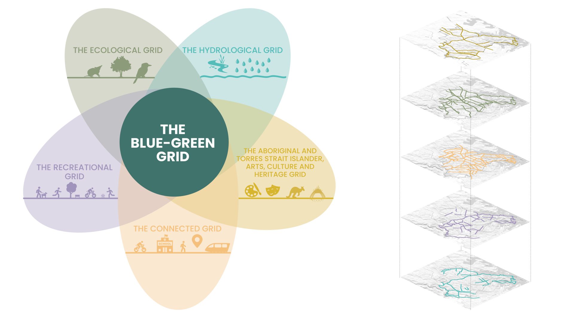
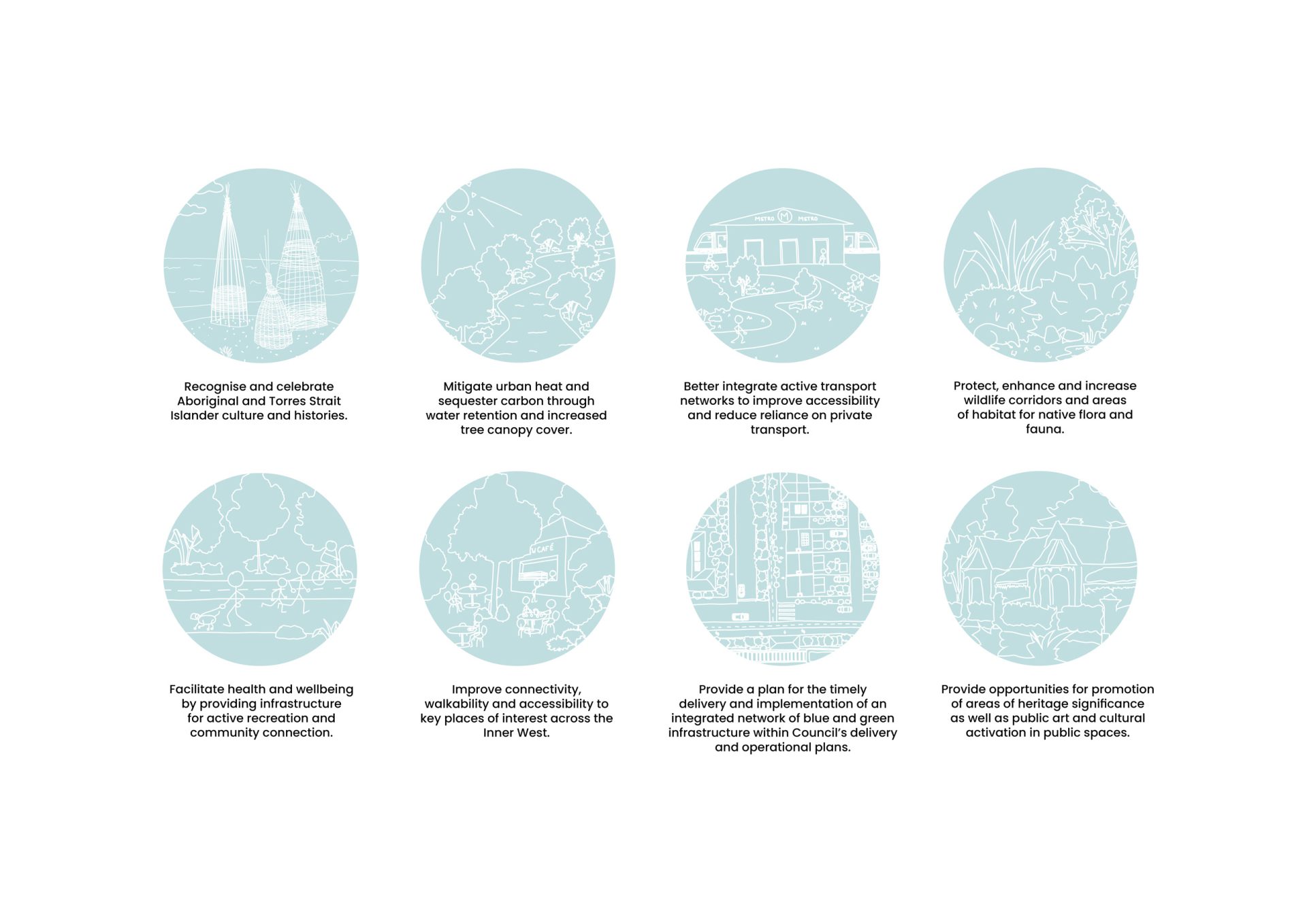
This strategy aims to foster a shared understanding and relationship with Gadigal and Wangal Country, integrating cultural narratives and environmental values. It is a key project in Council’s Local Strategic Planning Statement, aiming to create interconnected open spaces for improved recreation, urban tree canopy expansion, enhanced ecological communities, and better hydrology.

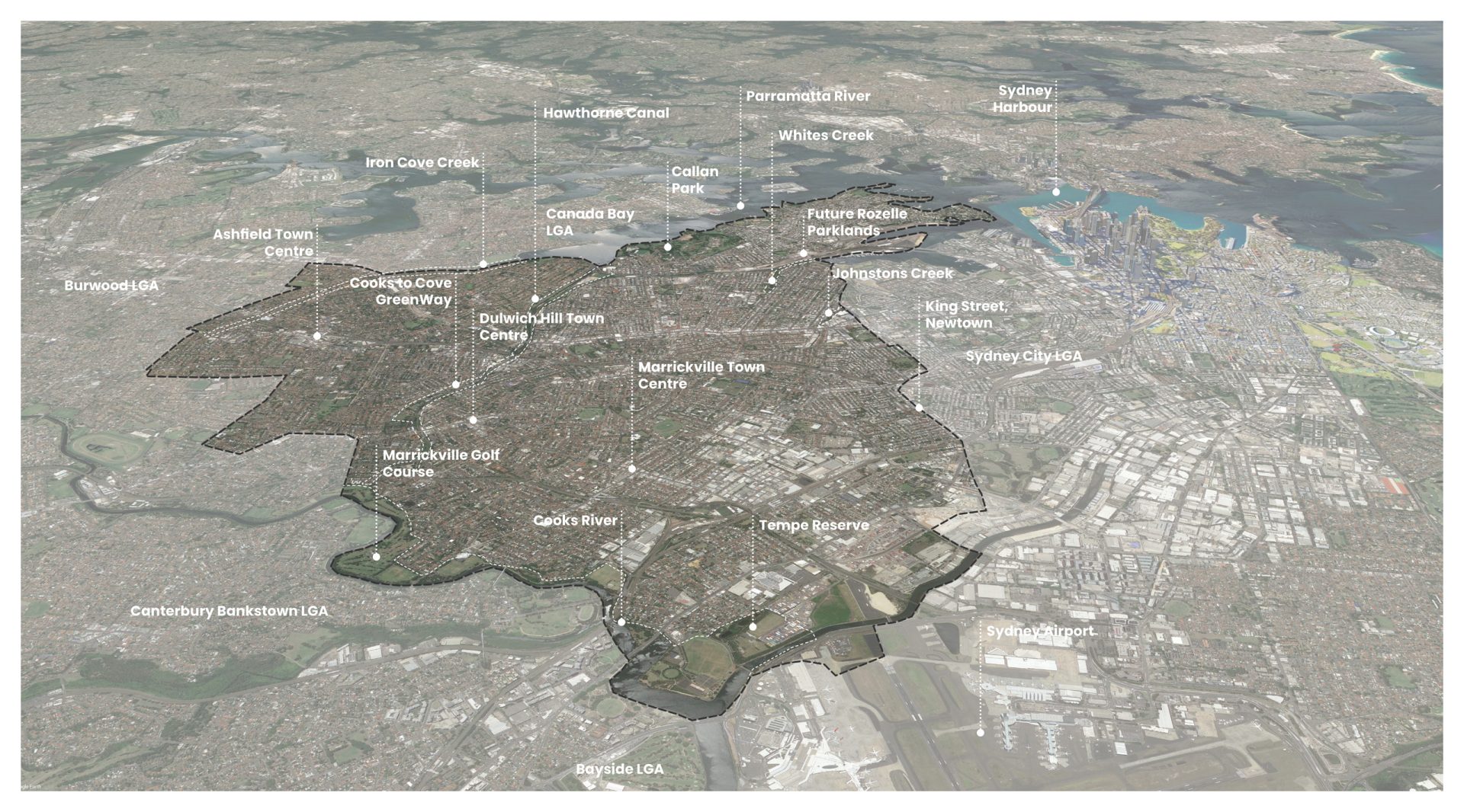
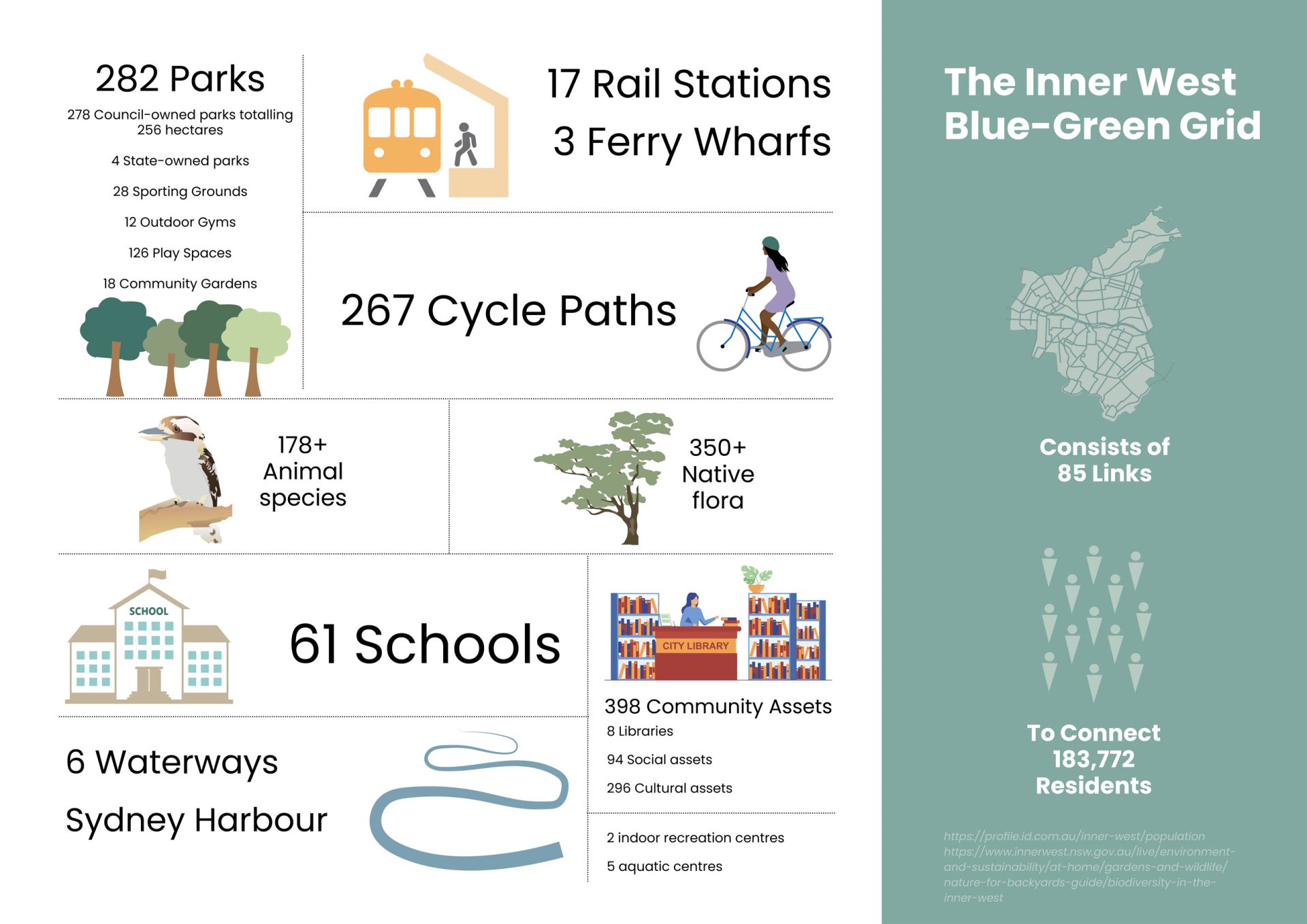
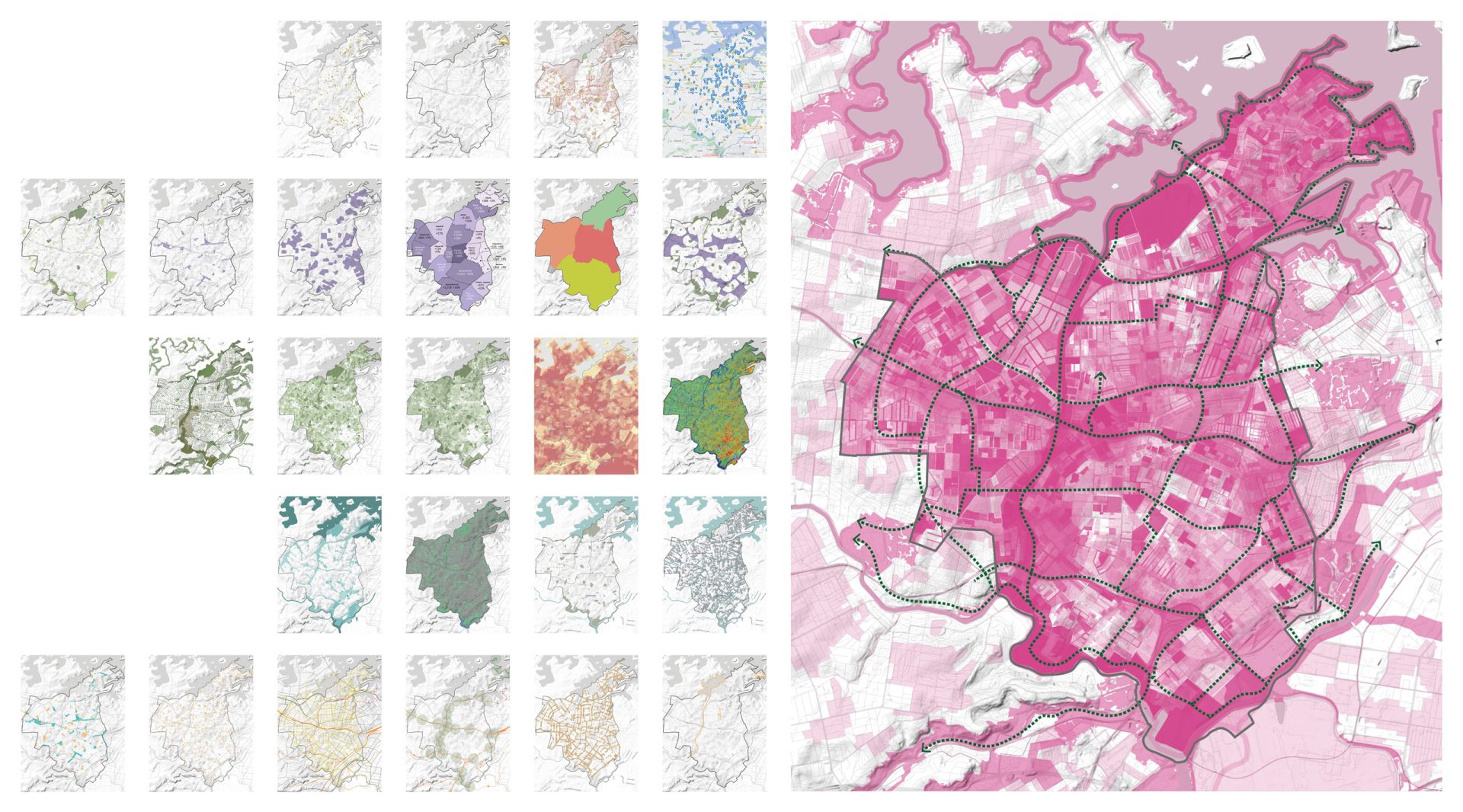
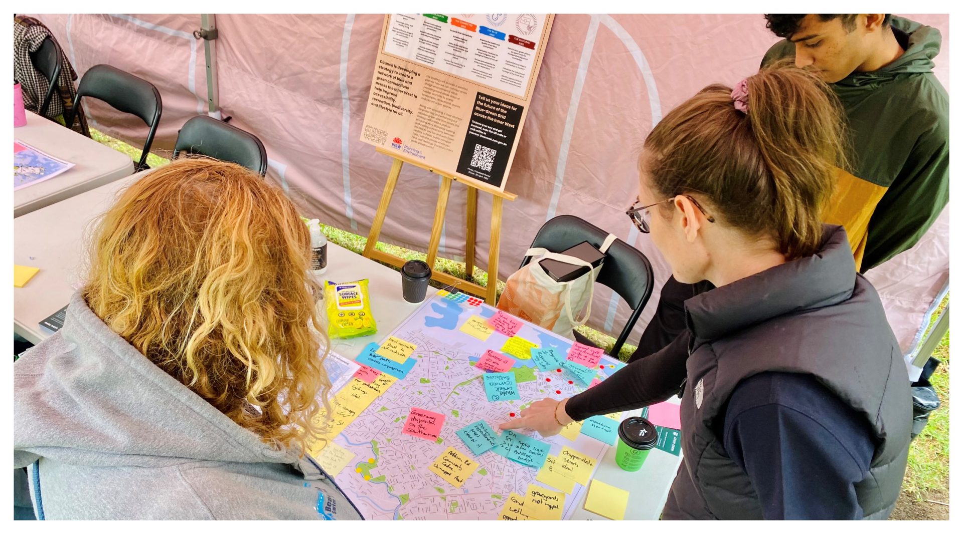
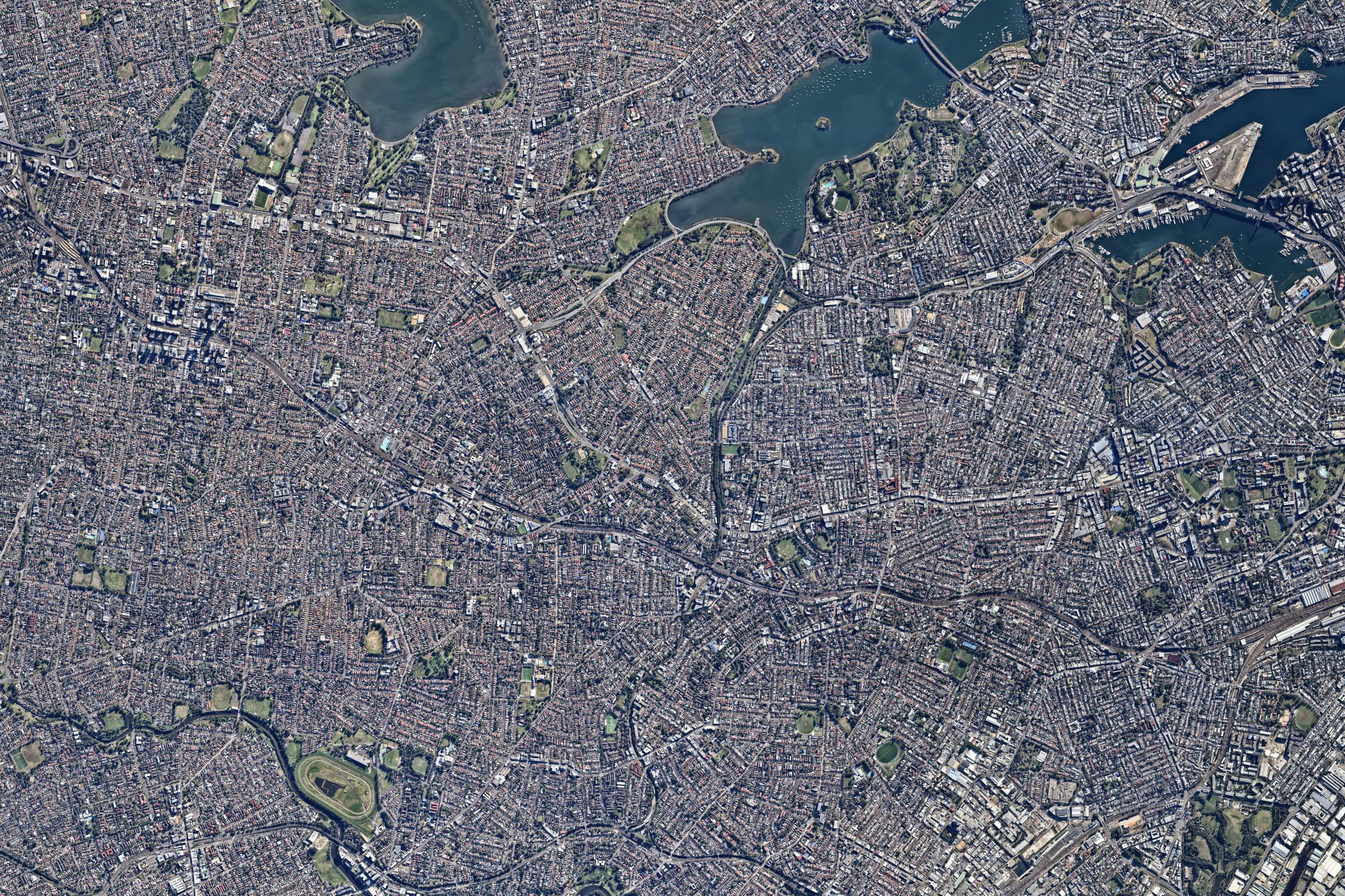
The Blue-Green Grid includes 84 key routes connecting schools, open spaces, railway stations, and key points of interest across the Inner West. It will link to regionally significant spaces like the Green Way, Bay Run, and Rozelle Parklands. The strategy is informed by community engagement and a review of existing data and plans.

The Blue-Green Grid Strategy is an aspirational long-term plan to coordinate future grant funding and local projects. It will create new travel routes and contribute to the Greater Sydney Green Grid, as outlined in the Greater Sydney Region Plan and the Eastern City District Plan. The project was funded by the NSW Government

Year

2023

Collaborators

  • Planning: EConPlan
  • Community Engagement: JOC Consulting
  • Economics and Feasibility: MBM Pty Ltd
A detailed aerial map highlights Marrickville in Sydney's Inner West, featuring notable locations such as Sydney Airport, Sydney Harbour, Burwood LGA, Iron Cove Creek, and Tempe Reserve. As part of the Blue-Green Grid strategy, labels for various town centers, parks, and rivers are visible within the outlined area.
A Venn diagram titled "The Blue-Green Grid" illustrates the strategy with overlapping areas: The Ecological Grid (green), The Hydrological Grid (blue), The Aboriginal and Torres Strait Islander Arts, Culture and Heritage Grid (yellow), The Recreational Grid (purple), and The Connected Grid (orange). On the right, a stacked grid of interconnected maps highlights the Inner West.
Infographic titled "The Inner West Blue-Green Grid Strategy" showing various elements: 282 parks, 267 cycle paths, 17 rail stations, 3 ferry wharfs, 178+ animal species, 61 schools, 6 waterways, over 350 native flora, 39 community assets, and serving 183,772 residents with 85 links.
A large, detailed map of a city with various shaded regions is on the right side of the image, highlighting different areas like the Inner West. Smaller maps in a Blue-Green Grid are arranged to the left, each representing different data sets or strategic views of the city.
Eight round icons with line-drawn images represent the following goals: celebrate culture and histories, mitigate urban heat through the Blue-Green Grid Strategy, integrate transport networks, enhance walkable areas and nature in the Inner West, enhance health, improve connectivity, promote cultural diversity, and support arts.
Three people are gathered around a table covered with a large map, colorful sticky notes, and pens. One person, wearing glasses and a vest, points at the map. An informational poster about the Inner West Blue-Green Grid Strategy is displayed on an easel in the background. Cups of coffee are on the table.

More Projects