fbpx

Falls to Hotham Alpine Crossing

Parks Victoria / Falls Creek, Australia

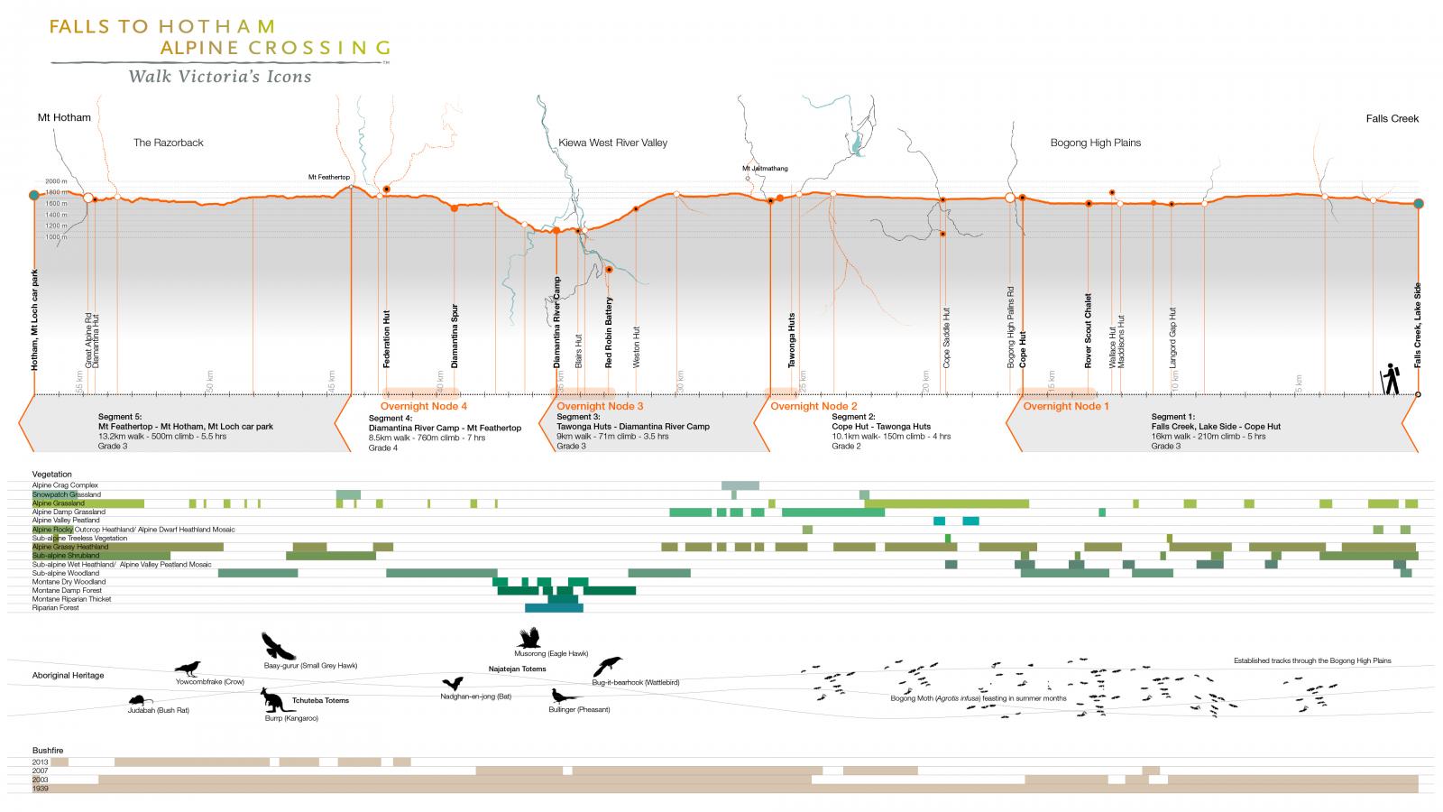
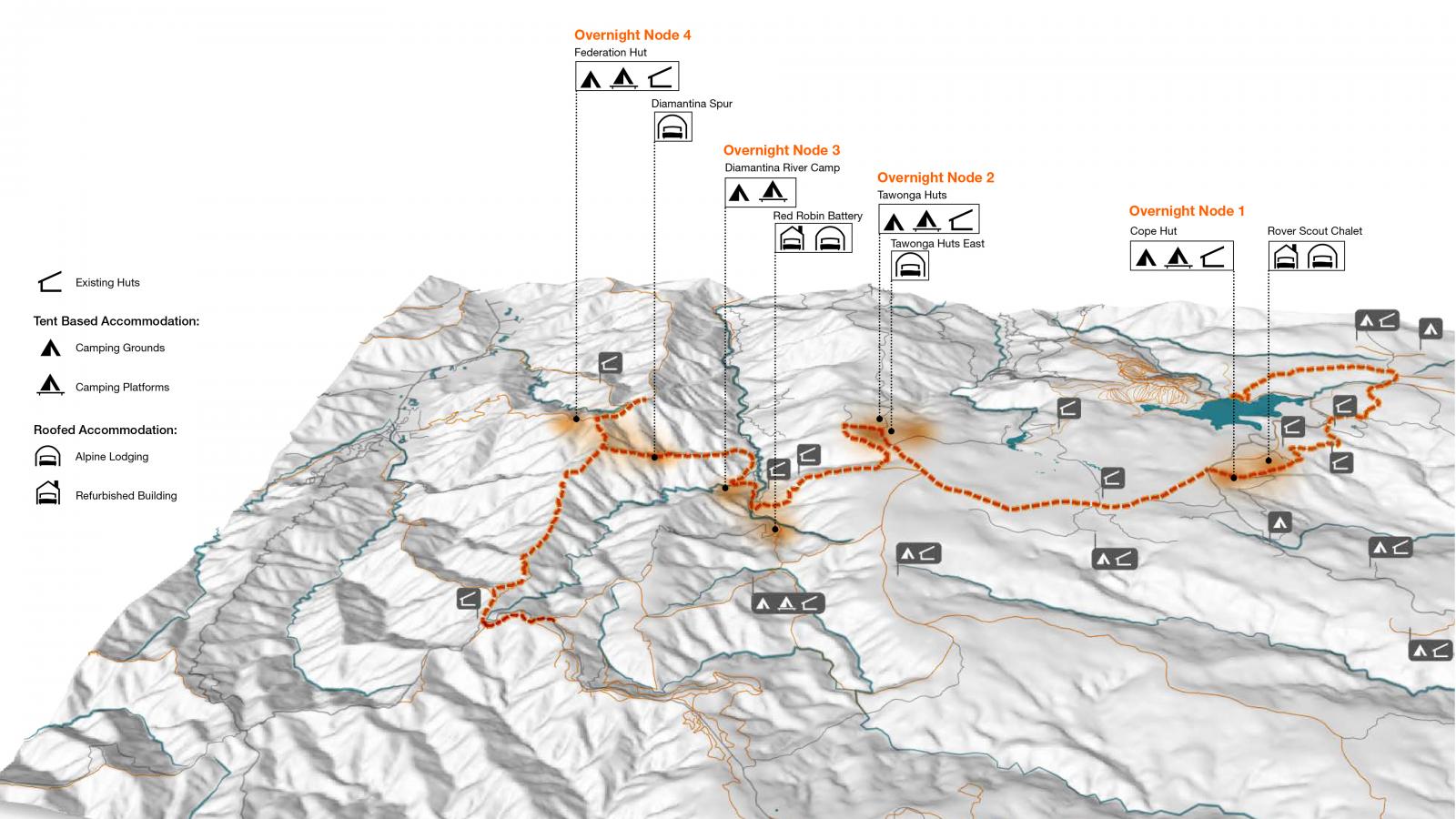
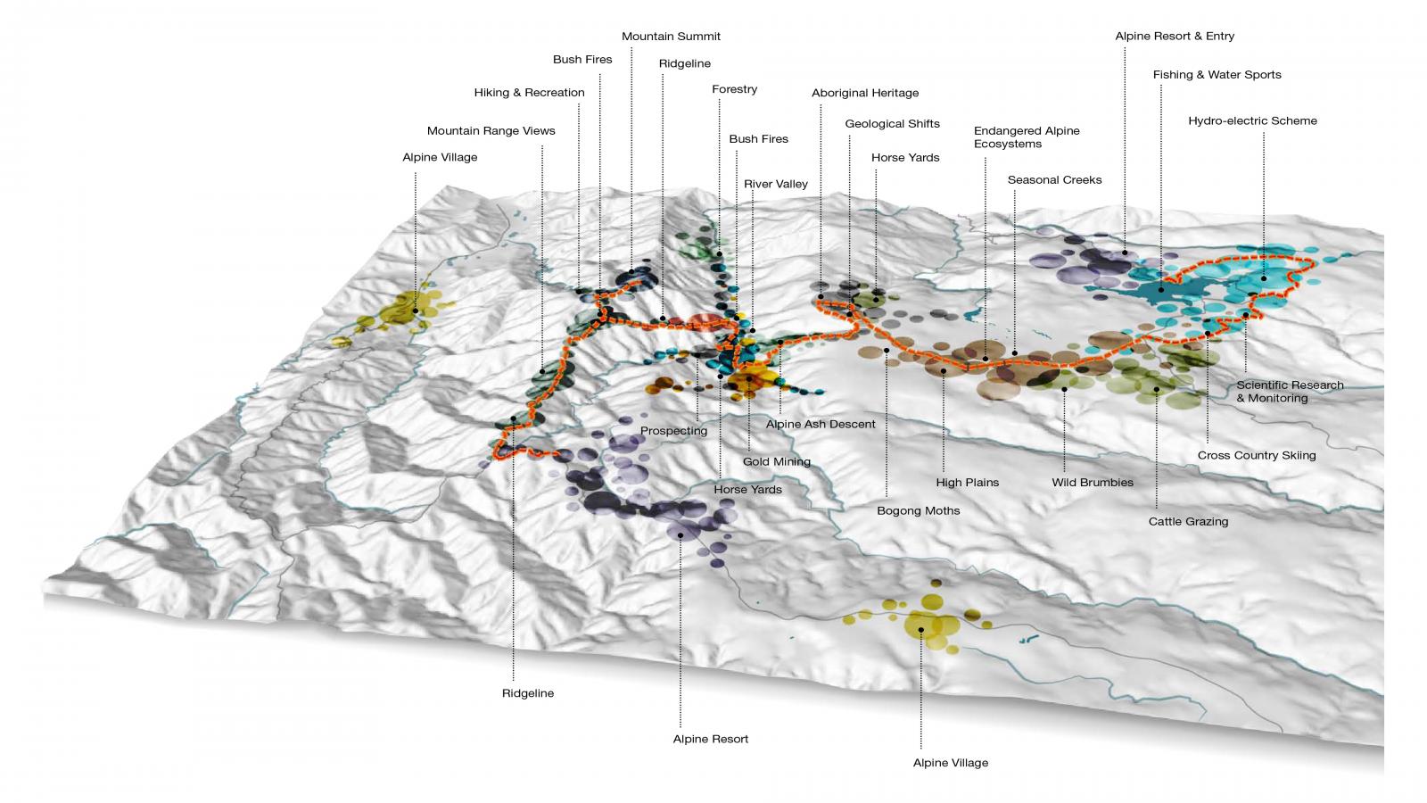
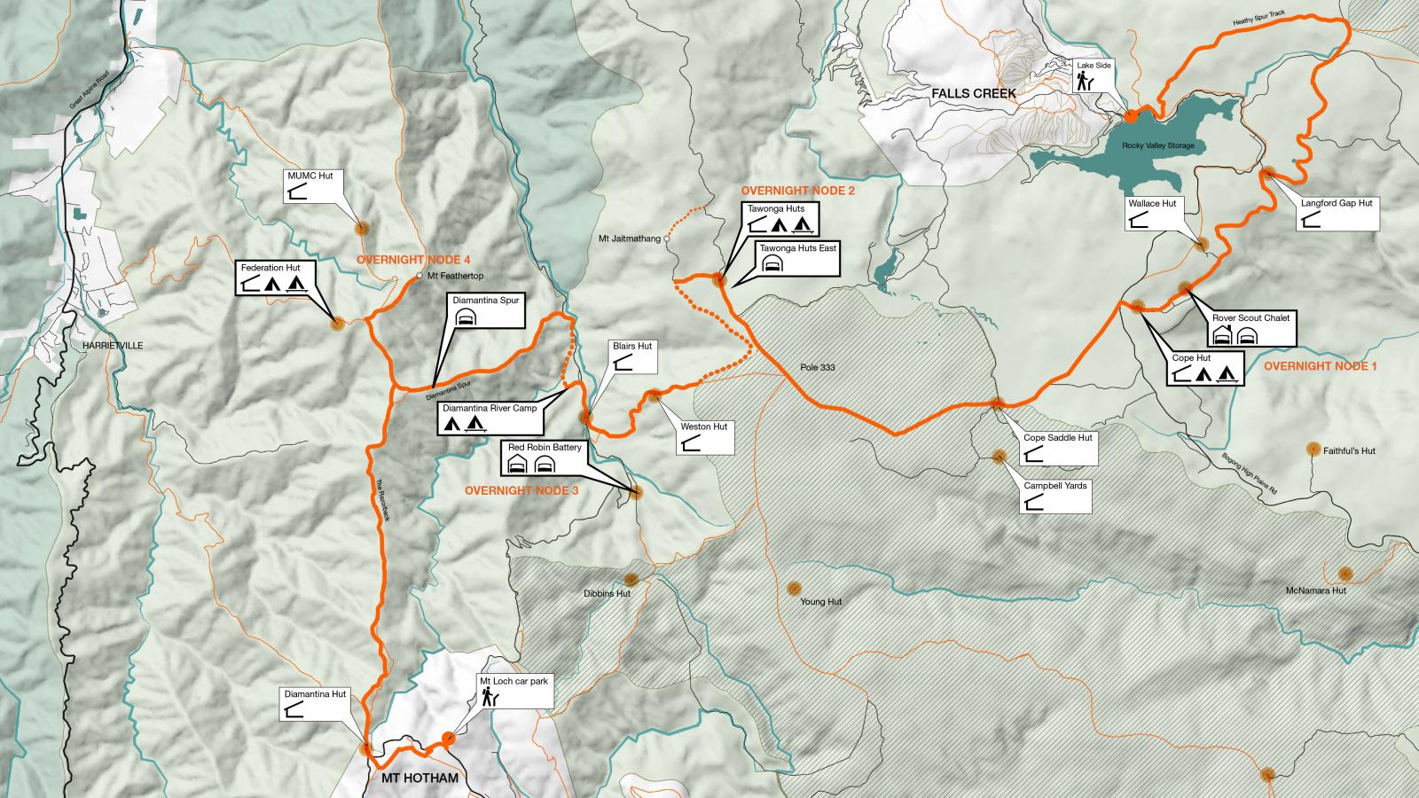
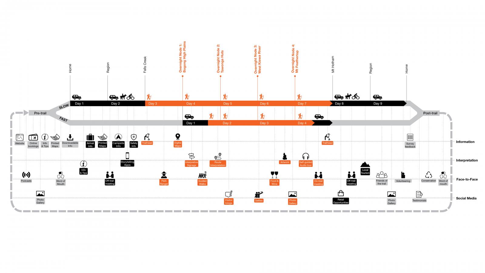
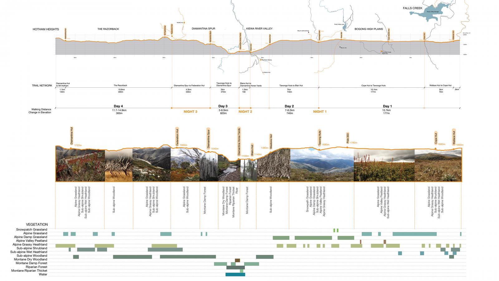
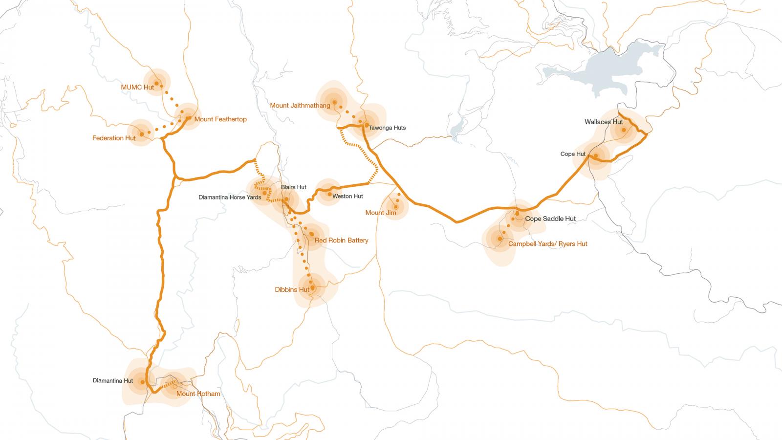
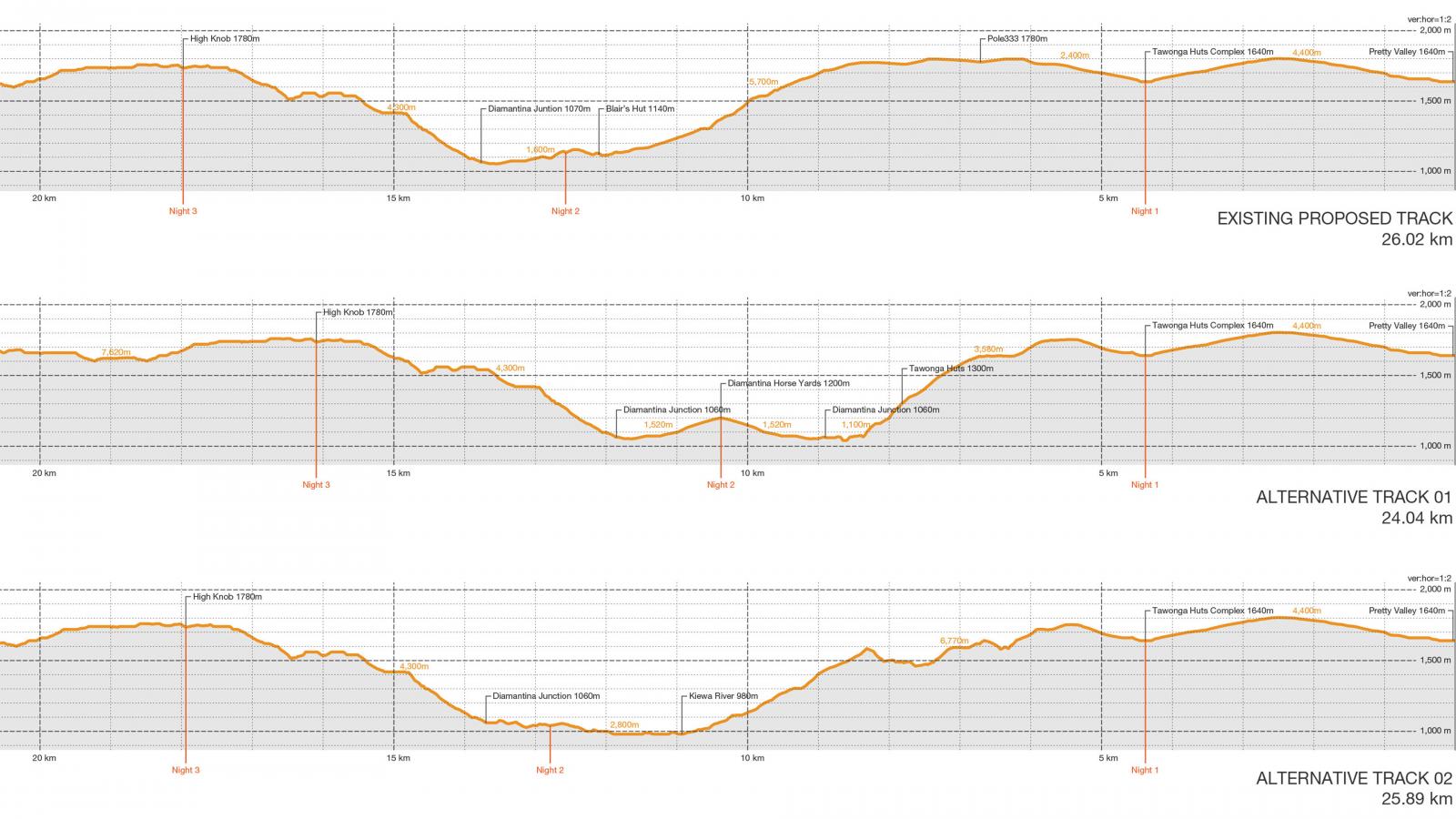
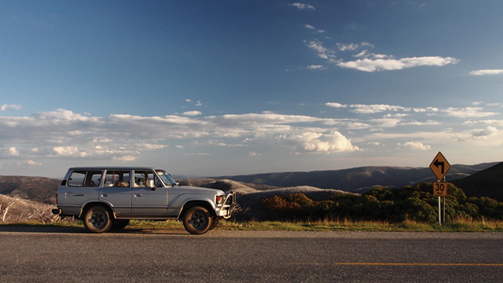
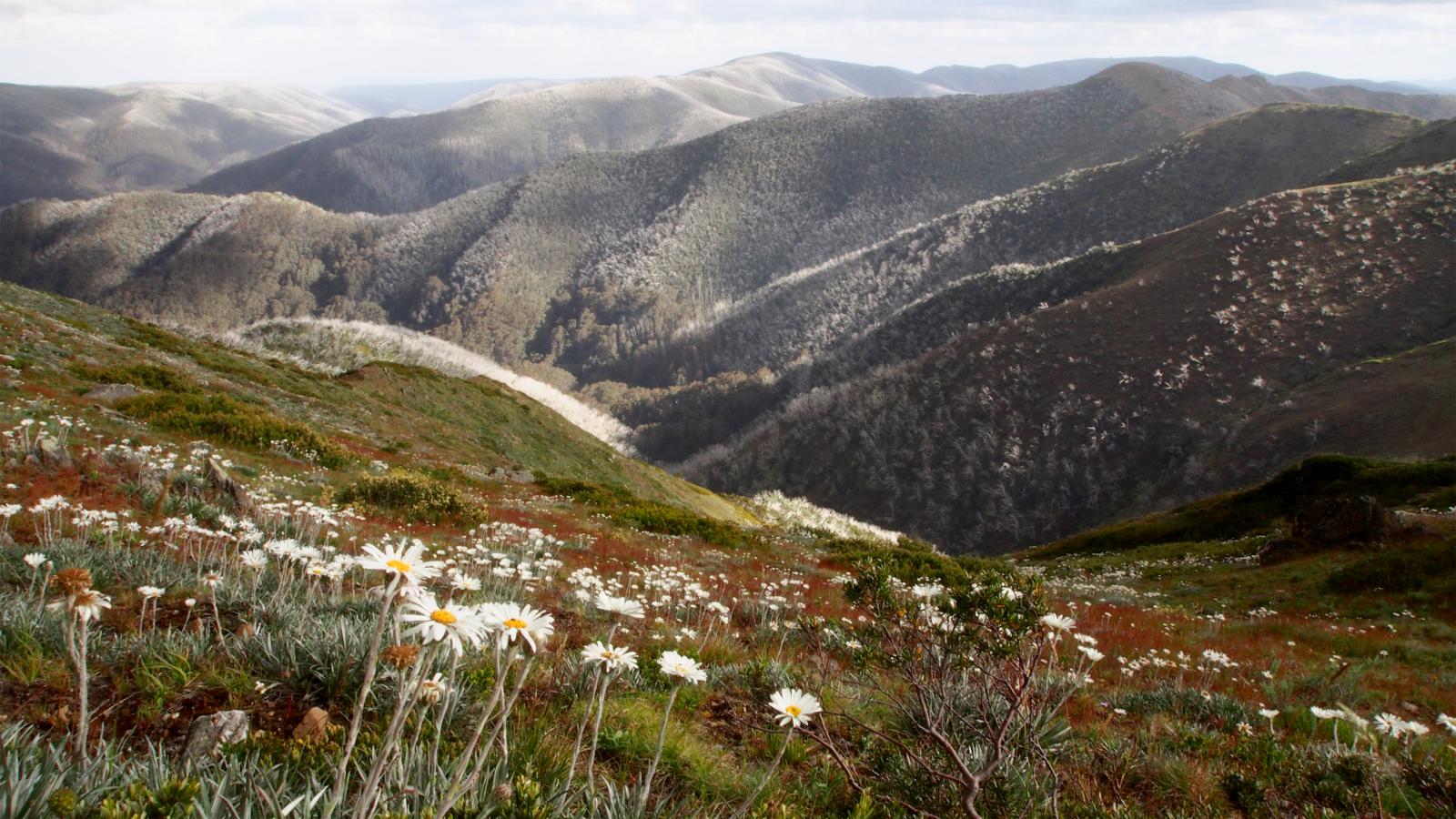
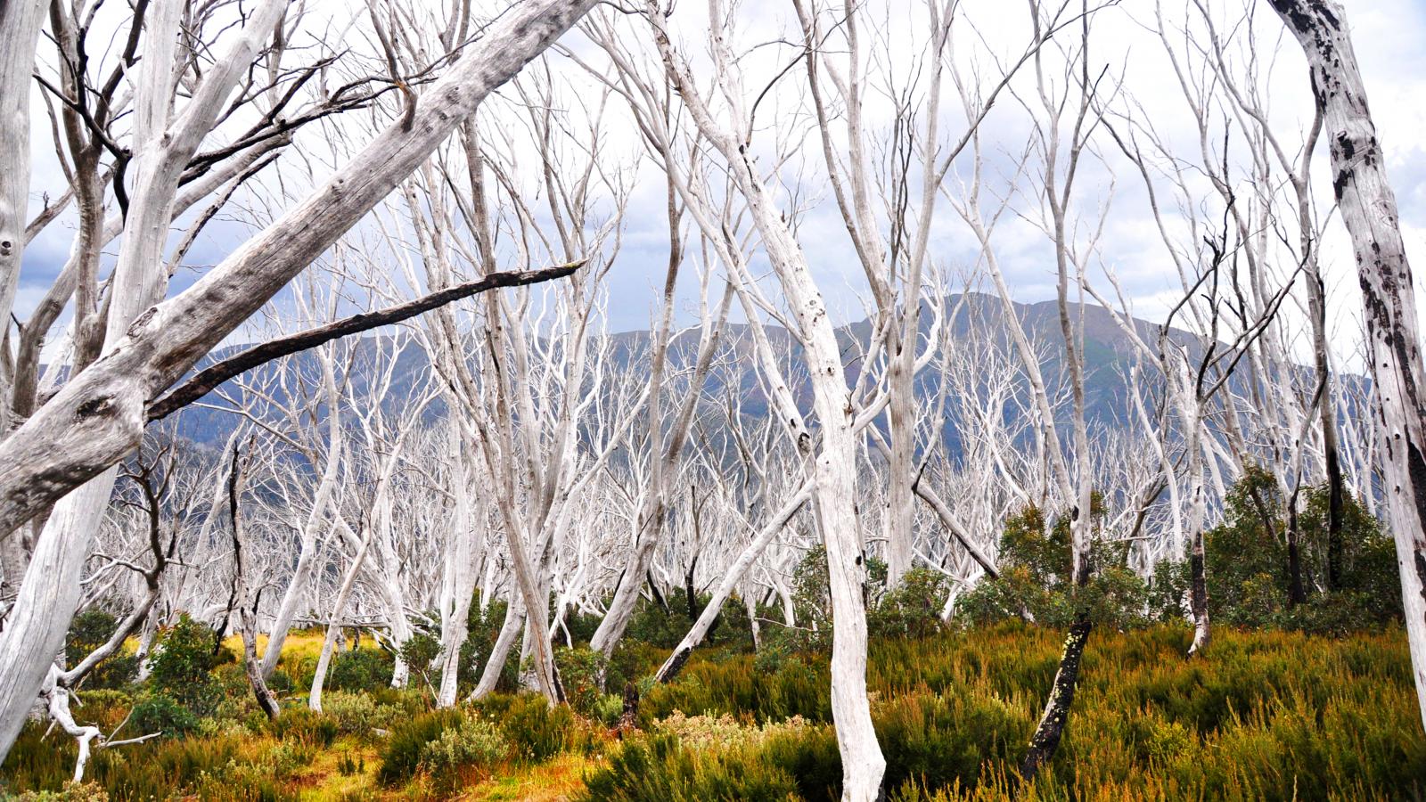
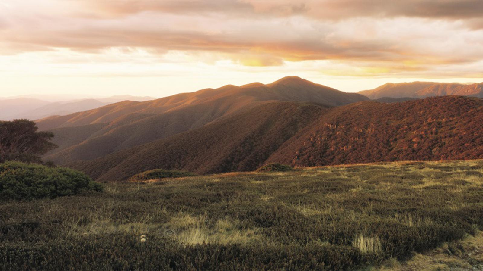
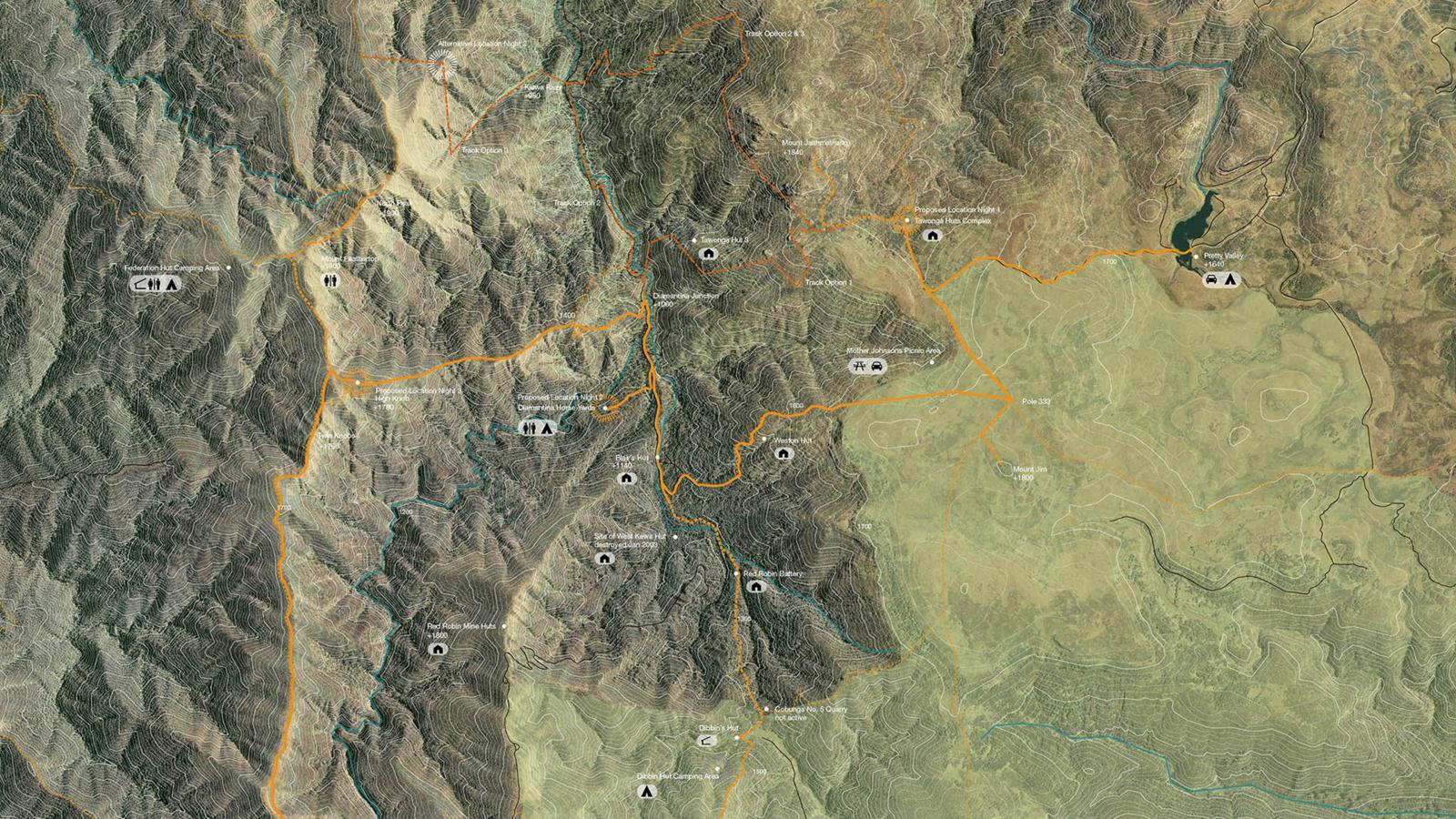
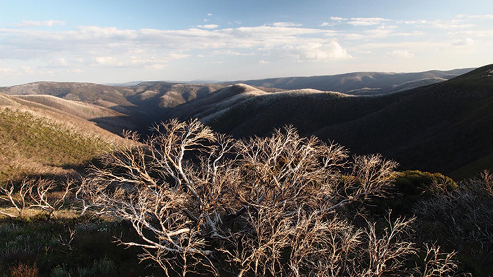
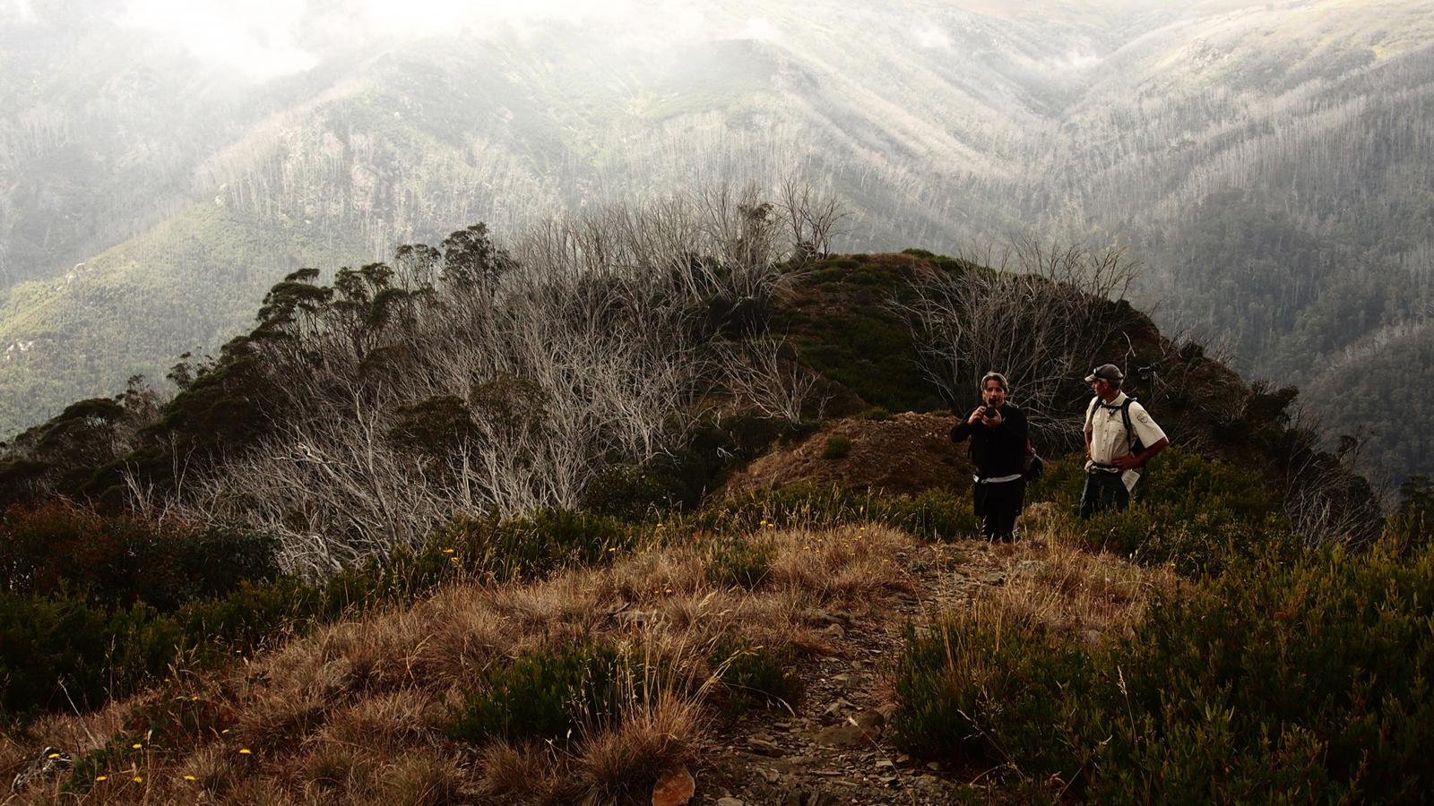
The Falls to Hotham Alpine Crossing is Australia’s world class alpine walking experience that captures the essence of the Australian Alps – the solitude, the seasons, the breathtaking beauty and the stories of the high country. McGregor Coxall was invited by Parks Victoria, on behalf of Tourism North East, Tourism Victoria and Regional Development Victoria for landscape architecture and master planning design services for the proposed Falls to Hotham Alpine Crossing [FHAC] in the Alpine National Park in Victoria’s north east.

The walk will conserve, protect and celebrate the Alpine National Park’s natural and cultural values, adding to the park’s already significant contribution to the Australian tourism industry. McGregor Coxall is leading a process to create a strategic plan and implementation strategy which considers regional and commercial tourism, the establishment of experiences on offer by the FHAC, and communicates the project vision and key principles.

Site Area

647.4 ha

Services

  • Community Engagement
  • Environmental Analysis + Statistics
  • Furniture and Signage
  • Guidelines
  • Landscape Master Plan
  • Recreation
  • Tourism
  • Visual Analysis

Collaborators

  • Simon Jones l.A
  • RV Gibbins
  • Zinc Cost Management Pty Ltd
  • Accuraco Project Management
  • Lightfoot Marketing
Black and white portrait of Nick Griffin, a man with short, wavy hair and a beard, wearing a textured sweater over a collared shirt. He is facing slightly to the right with a gentle smile against a neutral, plain background.
Talk to Nick Griffin about Falls to Hotham Alpine Crossing
Get In Touch
Infographic titled "Falls to Hotham Alpine Crossing - Walk Victoria's Icons." It features a detailed elevation profile, routes, and camp spots. The bottom includes timelines for vegetation types, animal habitats, birds, heritage, ecological concerns, and scenic points along the Alpine Crossing.
A topographic map of the Alpine Crossing hiking trail features orange-highlighted paths connecting several overnight nodes and points of interest. Various accommodations, including existing huts and camping platforms, are marked alongside the trail.
A 3D topographic map of a mountainous region showcasing various locations and activities, such as the famed Alpine Crossing route. Labels include mountain summits, forestry, hiking paths, geological sites, rivers, ski resorts like Falls to Hotham, and more. Colorful markers indicate site positions and connecting trails.
Topographic hiking map depicting multiple trails and overnight hikes in an alpine region. Icons indicate campsites, huts, and information points along the routes. The map highlights the Alpine Crossing from Mount Hotham to Falls Creek with detailed path connectivity.
Flowchart depicting a multi-day pedestrian experience, detailing transportation modes, activities, and engagement points across various days. Includes icons for cars, bicycles, walking, and services like information desks. Features the scenic Alpine Crossing from Falls to Hotham.
Illustrated Alpine Crossing hiking route with elevation profile, day-by-day breakdown, and vegetation types. Photos depict various terrains: rocky paths, grasslands, and forests. The timeline shows distances, elevations, and key landmarks for a multi-day trek from Falls to Hotham.
A detailed topographical map showcasing a network of interconnected trail routes in an alpine region. Key points such as mountains, huts, and valleys are marked with names, connected by highlighted trails like the renowned Falls to Hotham Alpine Crossing, indicative of trekking paths and significant waypoints.
A comparison chart showing elevation profiles for three different hiking tracks. The top profile represents the existing proposed track, Alpine Crossing, the middle one shows an alternative track, and the bottom profile displays a second alternative track such as Falls to Hotham. Distances and elevation changes are marked.
An older model silver SUV is parked on the side of a road with a mountainous landscape in the background. The sky is partly cloudy, and there is a yellow road sign indicating a right curve with a speed limit of 30 mph. This scenic route could be part of the Alpine Crossing to Falls to Hotham.
A mountainous landscape featuring rolling hills covered in a mix of green and brown vegetation. The foreground has a field of white daisies, while the background consists of tree-covered peaks, reminiscent of the scenic route from Falls to Hotham, with the sky visible above.
A dense forest of bare, white, leafless trees contrasts against a backdrop of lush green shrubs and mountains. The sky is overcast, adding a moody atmosphere to the scene. The stark whiteness of the trees along the Alpine Crossing suggests they may have been impacted by environmental factors.
A panoramic view of a mountainous landscape at sunset. The rolling hills, part of the renowned Alpine Crossing, are bathed in warm golden light, with layers of mountains fading into the distance. The foreground features grasslands with scattered bushes. The sky is painted in soft hues of orange and pink.
A detailed topographic map of a mountainous region showing various trails, campgrounds, and points of interest. The terrain has varying elevations, with marked paths like the Alpine Crossing and icons indicating facilities such as picnic areas, viewpoints, and water sources.
A scenic view of a mountainous landscape during the day, featuring rolling hills and valleys, reminiscent of the picturesque Alpine Crossing. In the foreground, clusters of leafless, gnarled trees stand tall, while the background displays vast, undulating ridges under a partly cloudy sky.
Two hikers stand on a rugged, narrow mountain trail surrounded by dense bushes. One hiker is taking a photo while the other looks on. Mist shrouds the distant forested mountains of Falls to Hotham, creating a serene and adventurous atmosphere of an epic Alpine Crossing.

More Projects