fbpx

Cooks to Cove GreenWay

Inner West Council / Sydney, Australia

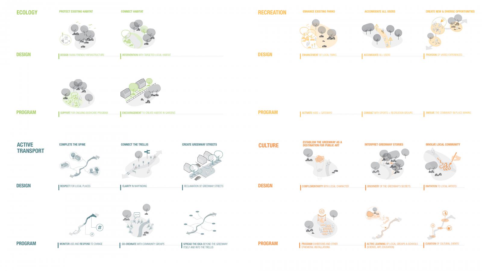
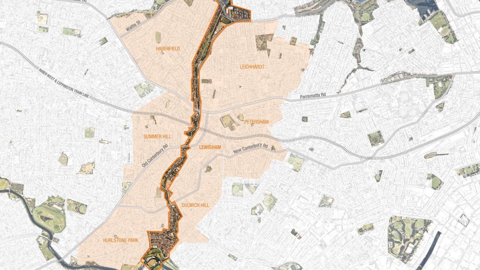
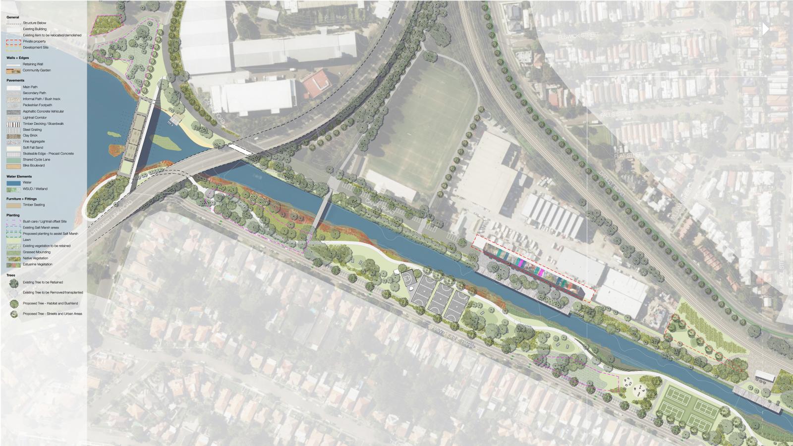
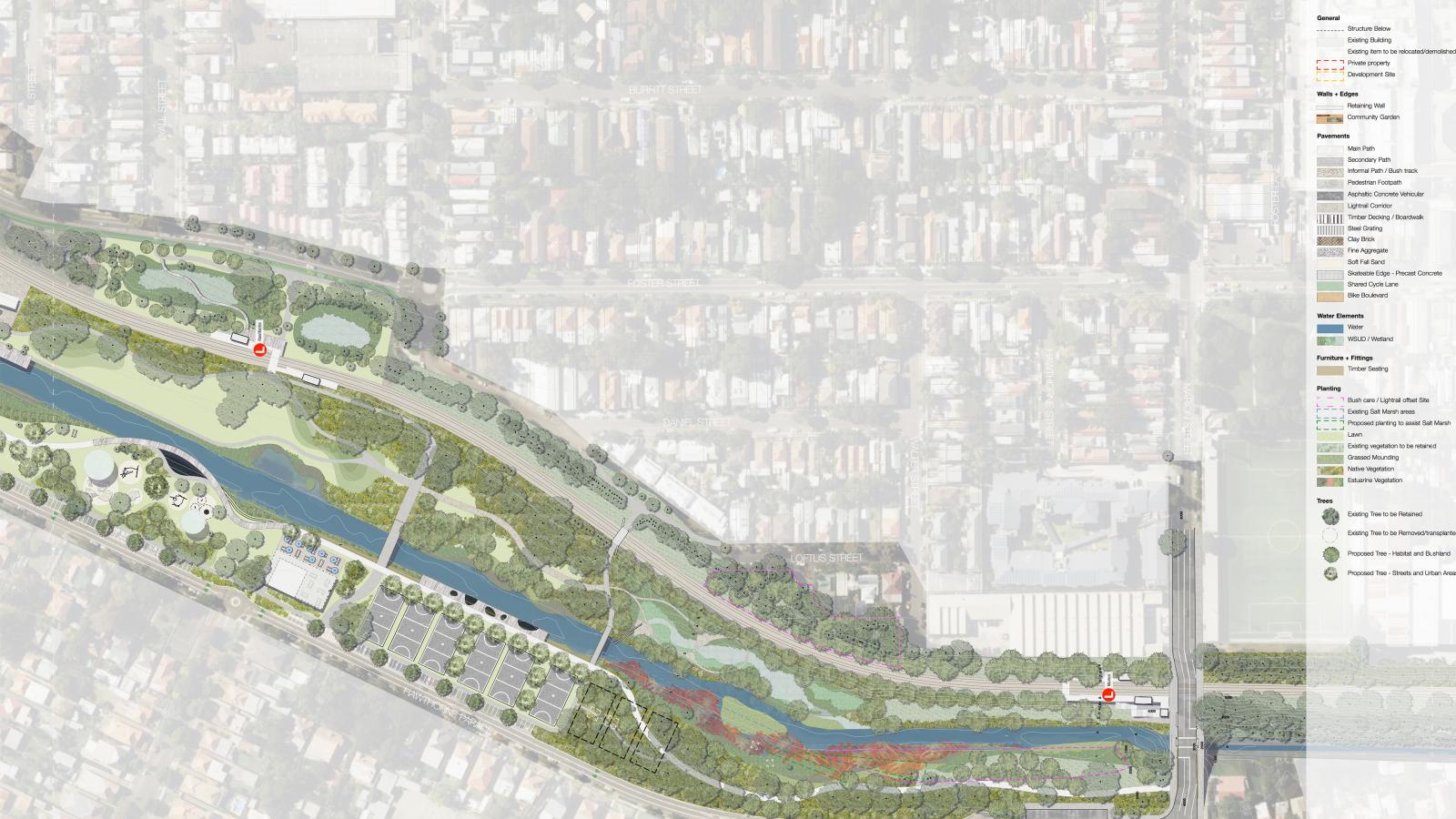
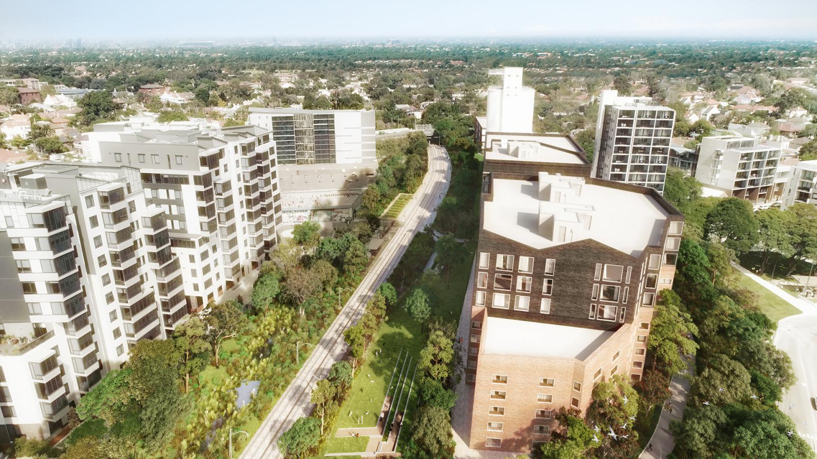
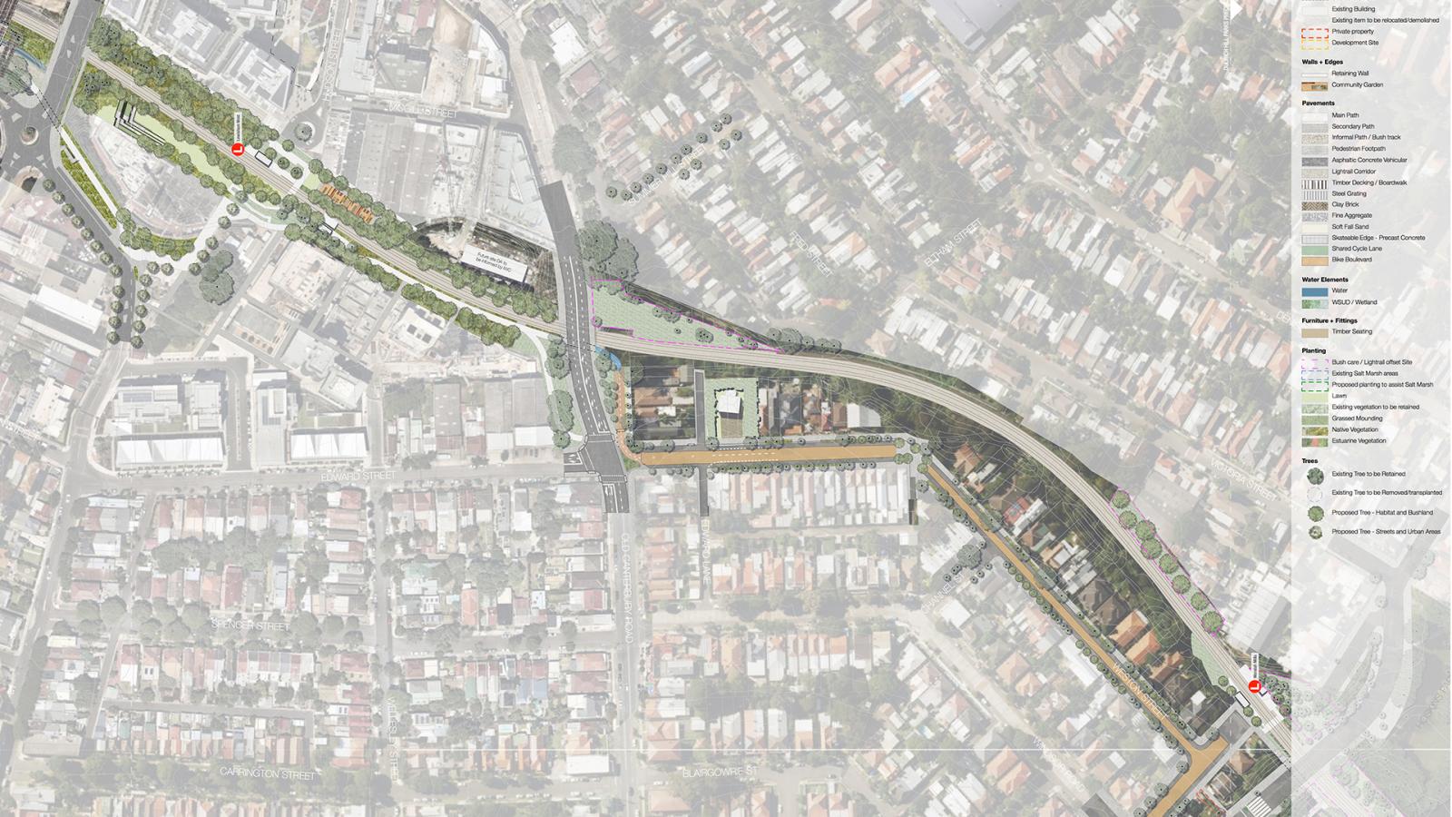
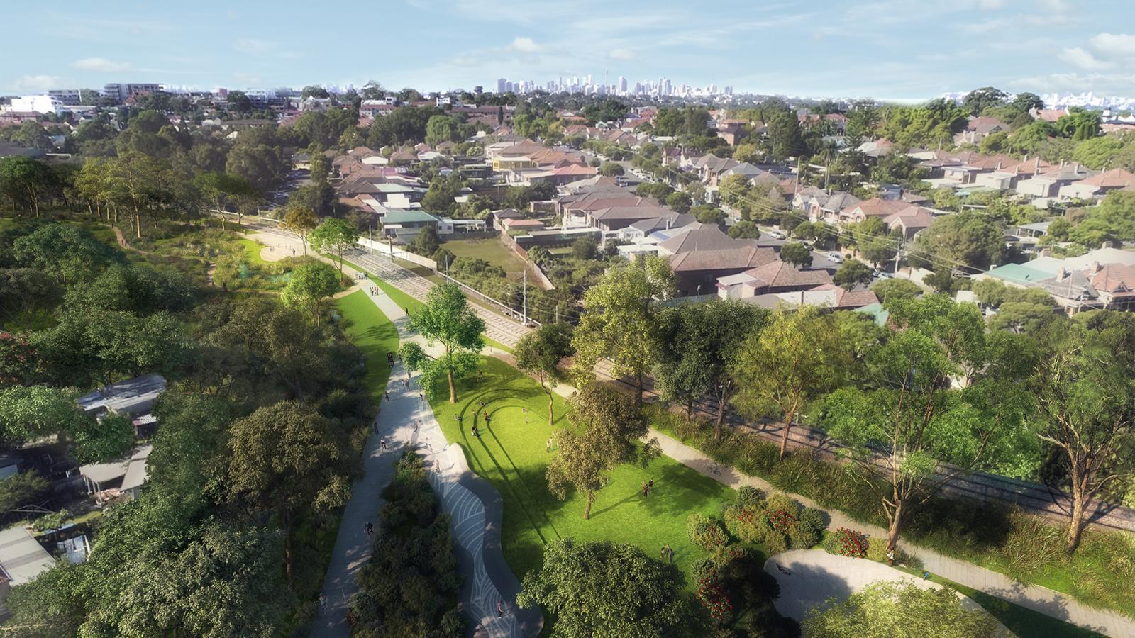
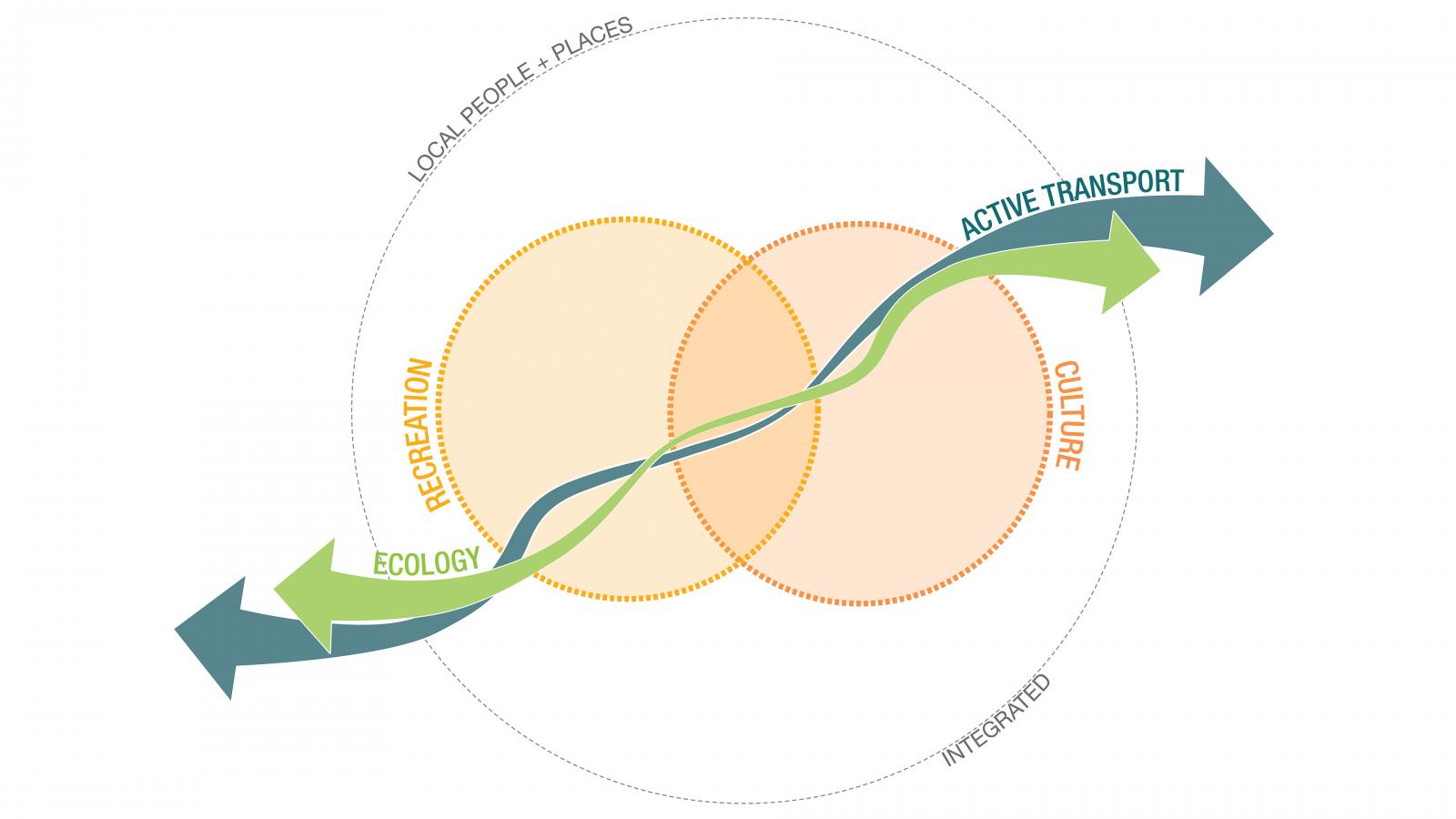
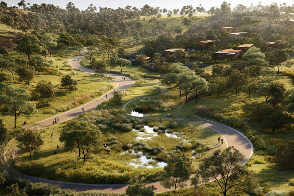
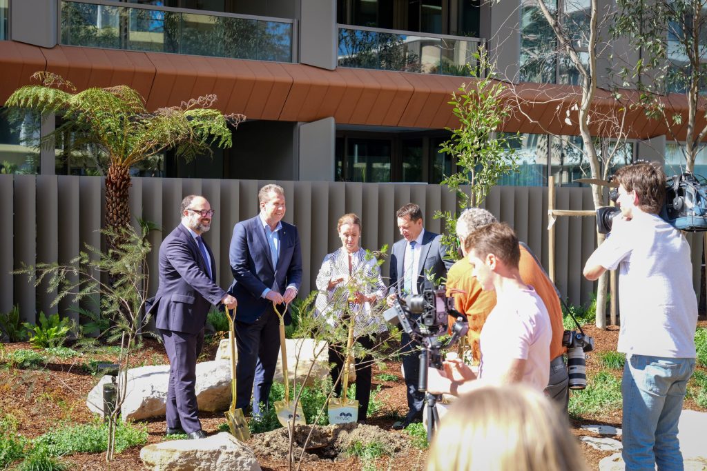
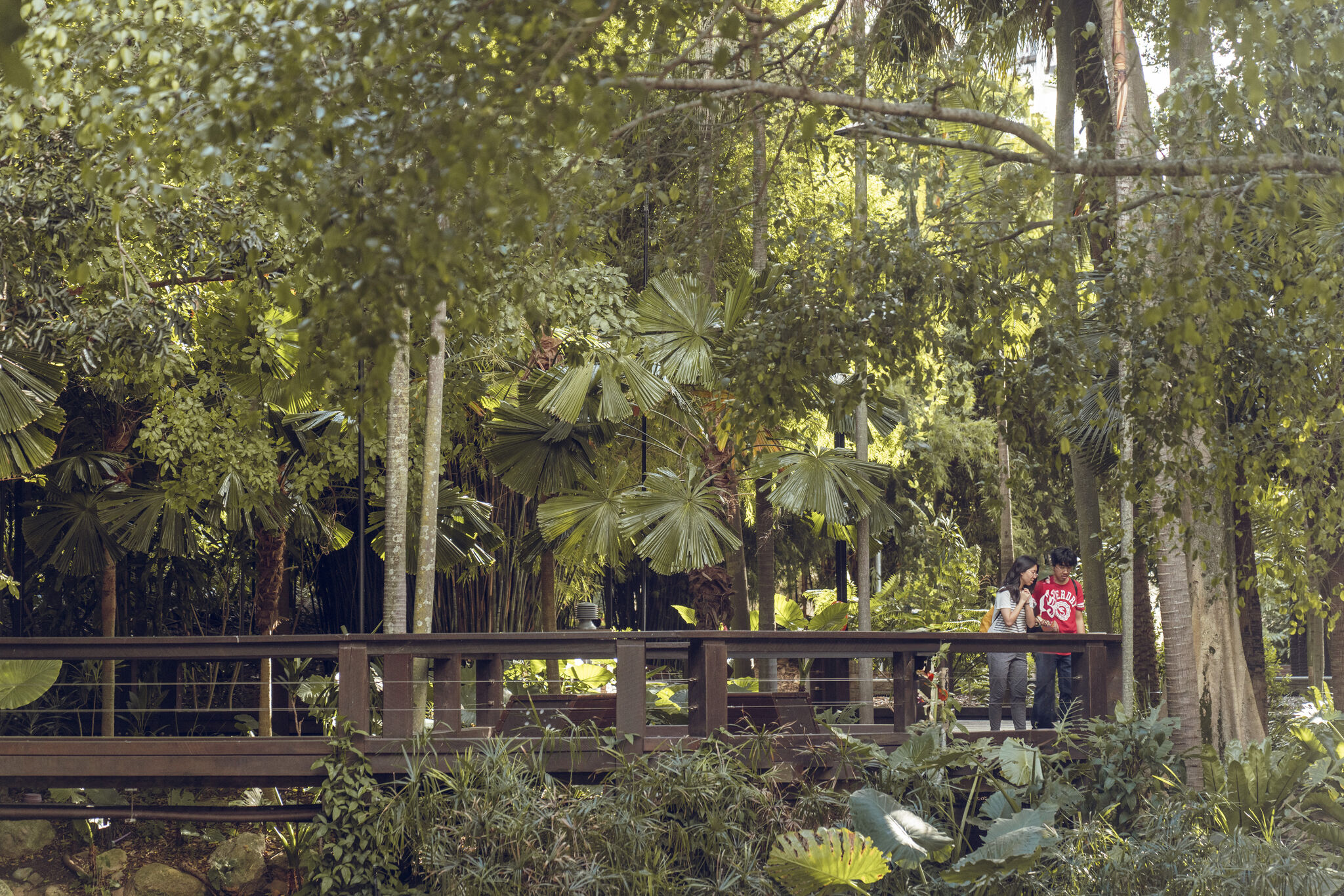
Following the route of the Inner West Light Rail, the GreenWay features bike paths and foreshore walks, cultural and historical sites, public art, community events, cafes, bushcare sites and a range of parks, playgrounds and sporting facilities. The Master Plan sets out a unique, integrated, place-based approach which combines the four main functions of the GreenWay – active travel, ecology, recreation and culture – in each of the six precincts along the 5.8km corridor.

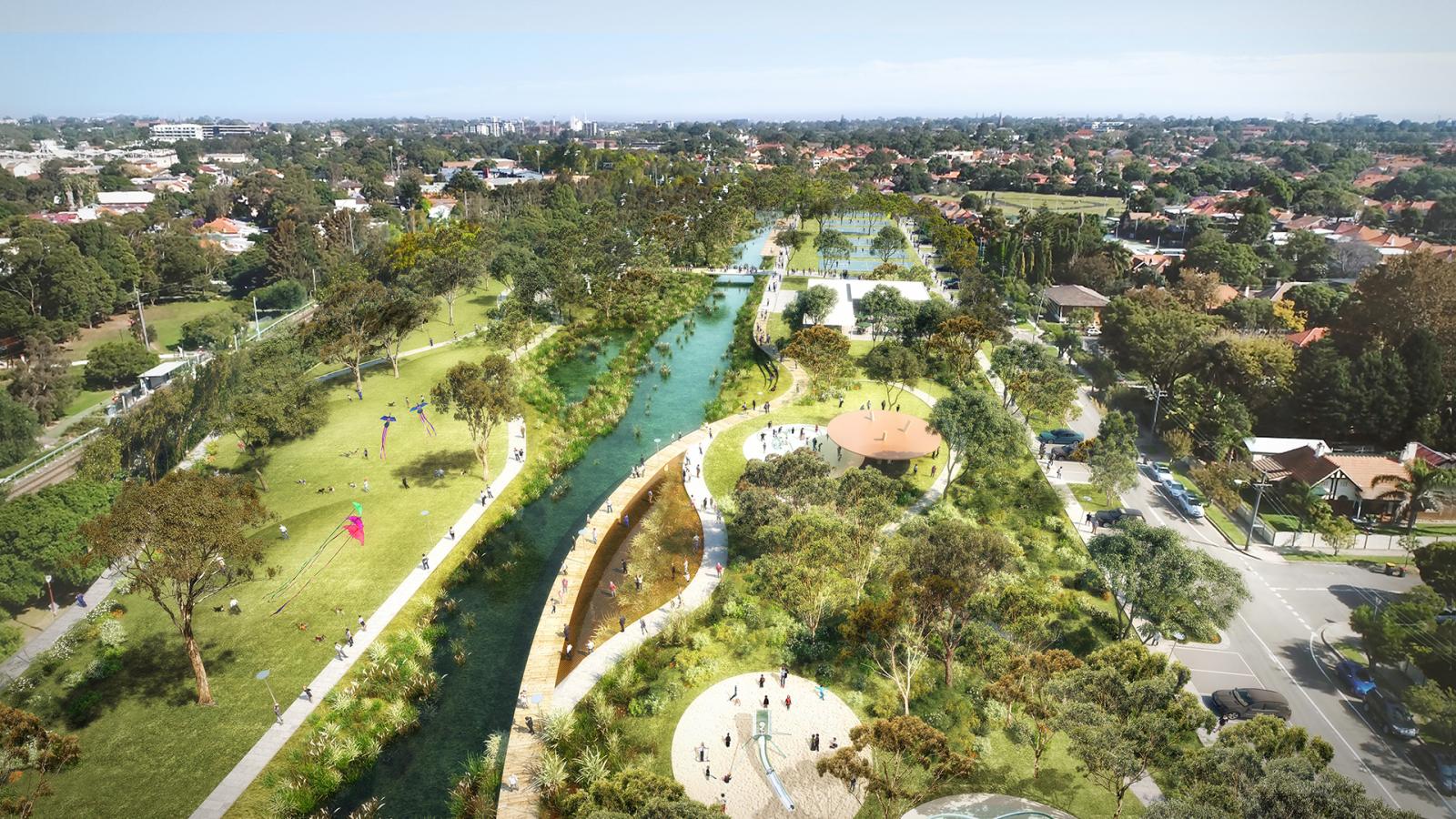
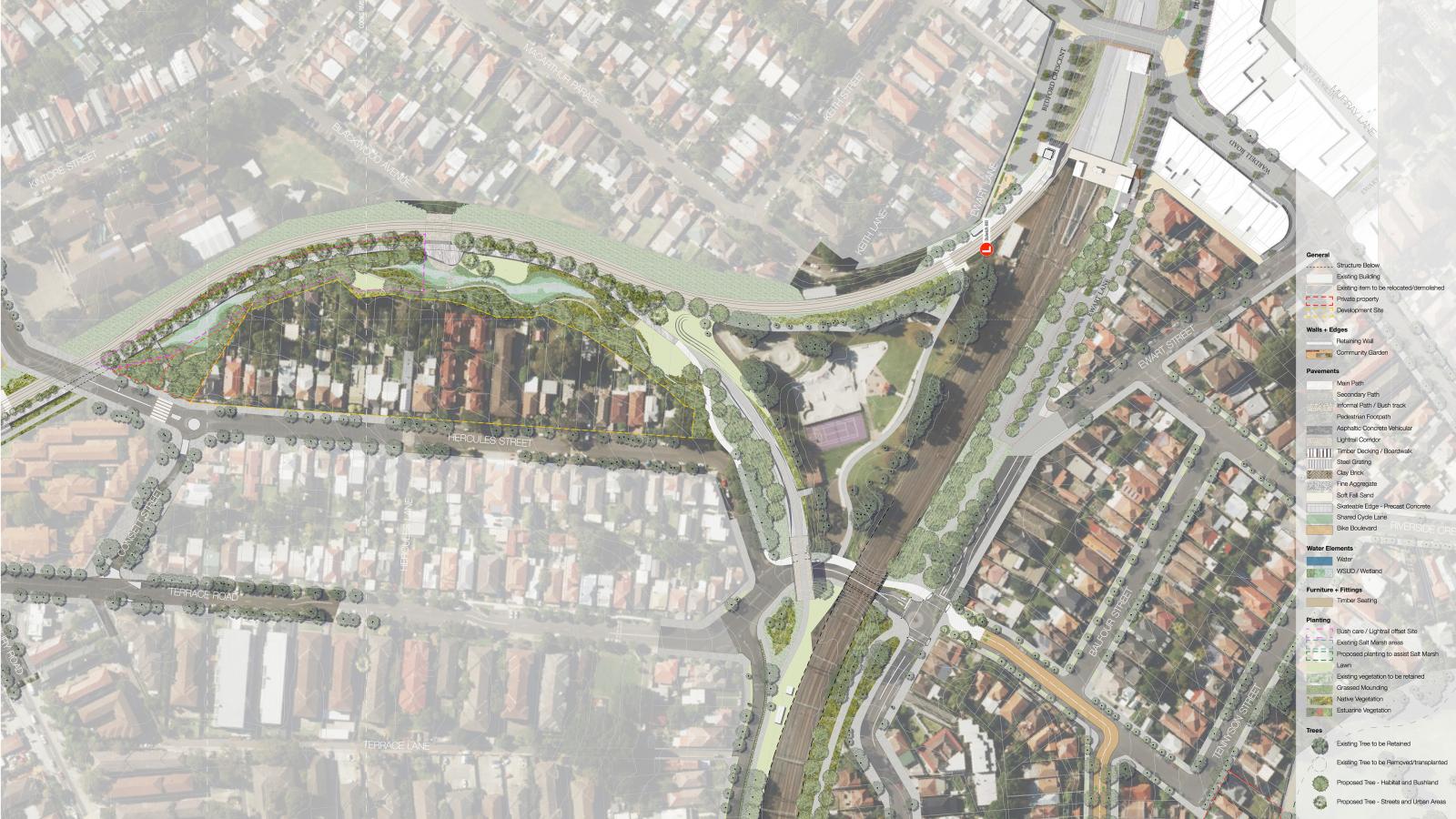
The masterplan proposes $57 million of investment and upgrades including more than 4 ha of revegetation and bank naturalisation, improvements to public open space and public art installations along the length of the corridor. A continuous shared path is proposed, including a new light weight pedestrian and cycle bridge under Parramatta Road and a tunnel under busy Longport Street. Other improvements proposed include extension of bushcare areas and up to three hectares of newly accessible public open space either side of the extended shared path, between Parramatta Rd and the Cooks River.

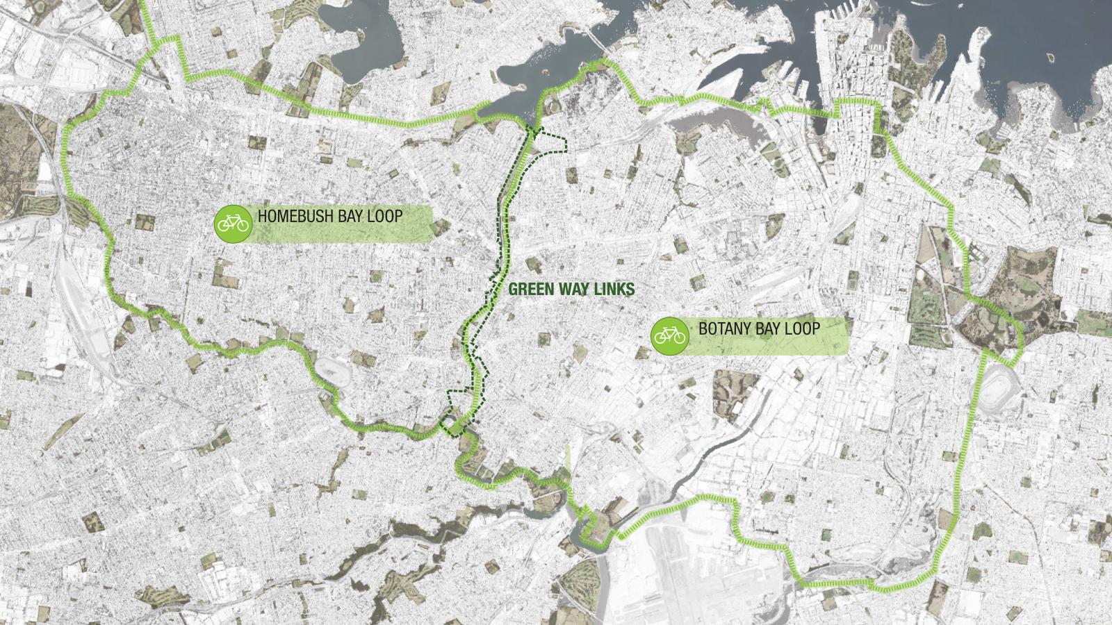
The Greater Sydney Commission has identified the GreenWay as the number one priority Green Grid project in the Sydney Eastern City District Plan. The Government Architect NSW has outlined the vision for a Green Grid network throughout the Sydney Metropolitan area. The priority status for the GreenWay reflects its location in a densely populated and increasingly urbanised inner city region.

Site Area

64 ha

Services

  • Art Installation
  • Community Engagement
  • Cycleways
  • Ecology
  • Environmental Analysis + Statistics
  • Heritage
  • Landscape Master Plan
  • Open Space
  • Public Art
  • Public Domain Strategy
  • Public Realm Planning and Design
  • Recreation
  • Regeneration
  • Shared Streets
  • Streetscape
  • Water Sensitive Urban Design [WSUD]
  • Stormwater Harvesting and Reuse
  • Tactical Urbanism

Collaborators

  • Jacobs Engineering Group Inc.
  • Lighting Art+Science
  • SDA Structures Pty Ltd
  • MBMpl Pty Ltd
  • SYNTHETICA
  • Inner West Council
A black and white portrait of Nadia Greatbatch, a woman with wavy, shoulder-length hair. She is wearing a textured black top, a leather jacket, and a pendant necklace. She stands against a plain background, looking directly at the camera with a neutral expression.
Talk to Nadia Greatbatch about Cooks to Cove GreenWay
Get In Touch
An infographic with four sections: Ecology, Recreation, Active Transport, and Culture. Each section includes subsections labeled Design and Program, featuring illustrated graphics and text detailing various initiatives. Highlights include the Cooks Cove GreenWay project integrating local heritage and sustainable travel.
A detailed map shows two cycling routes in an urban area: the Homebush Bay Loop and the Botany Bay Loop. Both loops and their connecting paths, known as Green Way Links, are highlighted in green. The map includes surrounding bodies of water like the Cove and city infrastructure.
A map showing part of London, highlighting several neighborhoods in shades of tan. Notable areas marked include Harlesfield, Lednork, Summers Hill, Petrospark, Lewisham, Dulwich Hill, Lework, Hurlstone Park, and GreenWay. The map features roads, parks such as Cooks Cove Park and rivers.
Aerial view of GreenWay, a large urban park featuring a winding river with lush greenery, walking paths, and open grassy areas. People are seen enjoying various activities. The park is surrounded by residential neighborhoods and buildings in the background.
An overhead map showing a proposed urban park and river development. The image displays the GreenWay with greenery, paths, and pedestrian bridges along the river, adjacent buildings, and roads. Detailed legends depict various elements like trails, native vegetation, and amenities.
A detailed landscape plan depicting an urban river corridor with multiple ponds, green spaces, footpaths, parking areas, and dense tree planting. Residential areas are visible in the background. A legend on the right side indicates various design elements and features along the Cooks GreenWay.
Aerial view of a green and urban neighborhood featuring modern multi-story residential buildings surrounded by lush trees and pathways, with the GreenWay trail running through it. In the distance, a horizon of a sprawling cityscape can be seen under a clear blue sky.
A detailed aerial map shows a proposed layout for the GreenWay urban rail corridor, featuring new green spaces, footpaths, and stations marked with icons. Surrounding residential and commercial areas, streets, and key landmarks like Cooks Cove are visible in the background.
Aerial view of a suburban neighborhood surrounded by lush greenery. A well-maintained park, named GreenWay, with walking paths, trees, and open grassy areas lies in the foreground. Rows of houses are visible in the middle, with a distant city skyline in the background.
A detailed aerial view of a suburban area, showcasing roads, residential buildings, parks, and infrastructure development. The image highlights green spaces, roadways like GreenWay, and a railway line cutting through the area. Points of interest such as Cooks Cove are also labeled for easy reference.
A Venn diagram with overlapping circles labeled "Recreation" and "Culture." An arrow labeled "Active Transport" flows through the overlap, connecting smaller arrows labeled "Ecology" and "Integrated." Text around the diagram reads "Local People + Places," featuring GreenWay near Cooks Cove.
Aerial view of GreenWay park with a winding river flowing through it. Walking paths, small bridges, and shaded seating areas are visible. People are enjoying various activities, and there are residential buildings and trees in the background.

More Projects