West Belconnen Open Space Strategy

Riverview Group / Canberra, Australia

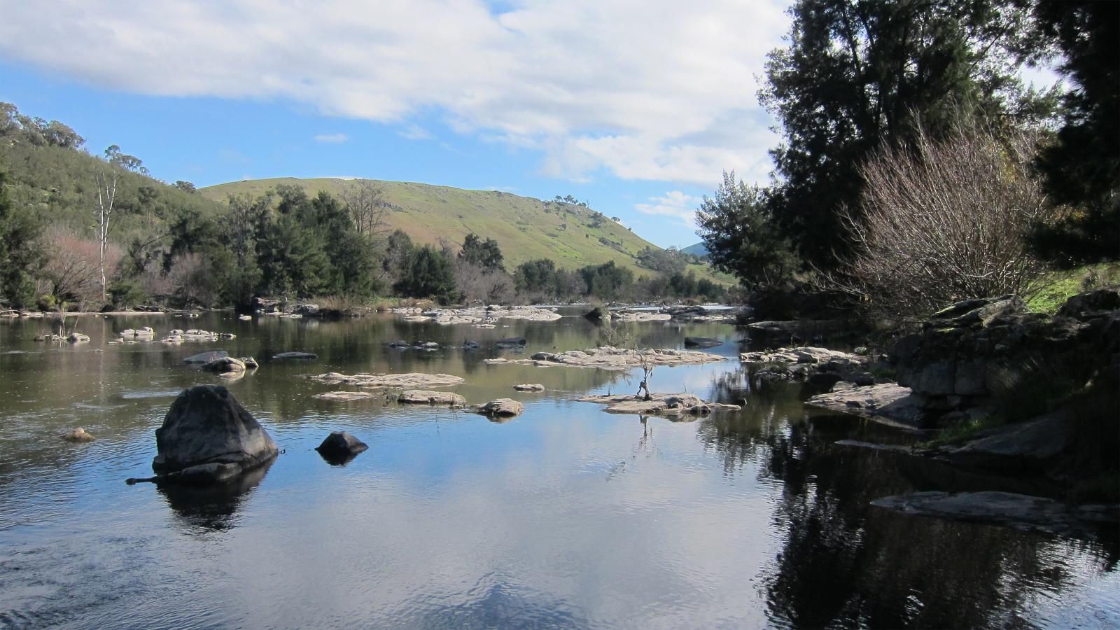
McGregor Coxall was engaged to create the Open Space Strategy for West Belconnen, a proposed 21st Century Garden Suburb straddling the ACT/NSW border. The 1600ha development will be home to 30,000 people and is a Green Star Communities Pilot Project, aiming for a 6 star rating. The site is bounded to the west by the Murrumbidgee River with a 560ha River Corridor Conservation Area protecting nationally significant ecological communities.

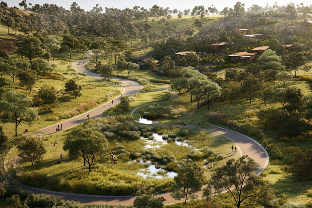
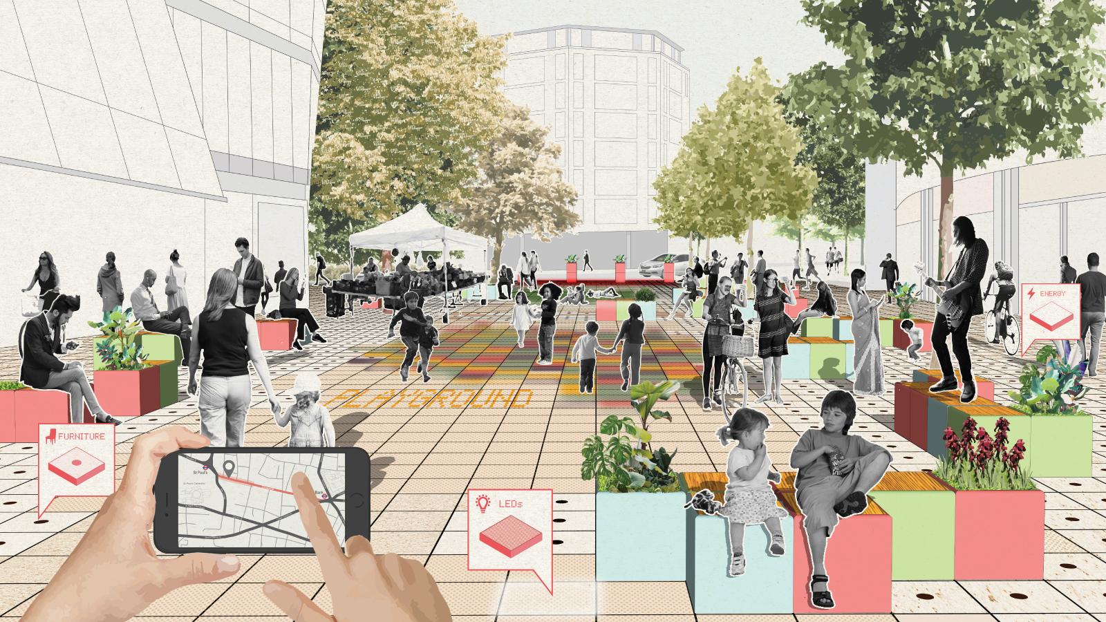
The site presents unique opportunities for re-thinking the way residential communities are created, including re-use of an existing landfill utilising industrial ecology, incorporation of urban agriculture, alternative energy production and programming 87ha of land located within transmission line easements. As part of the open space strategy, McGregor Coxall has developed a suite of street typologies integrating community and ecological functions into the street network. The Open Space Strategy will connect the community with the natural environment and present a wealth of experiences and opportunities for residents.

Site Area

160 ha

Services

  • Land Use and Spatial Studies
  • Landfill Remediation
  • Landscape Master Plan
  • Streetscape
  • Energy and Solar Farm Masterplanning
  • Water Sensitive Urban Design [WSUD]
  • Catchment Flow Models
  • Cloudburst Design
A detailed map showcases a master plan for an urban development in West Belconnen. It features designated zones for residential areas, parks, roads, and open spaces, all set against the backdrop of water and natural landscapes. The strategy emphasizes a balanced integration of urban and natural elements.
A series of six labeled maps indicating different zones in the West Belconnen region. Labels read: "Conservation Corridor & Grindinderra Creek Corridor," "Transmission Easements," "Landfill," "Parks & Recreation Spaces," "Movement Network," and "Site Plan." Each map highlights specific areas as part of the open space strategy.
A detailed aerial map illustration of a large, multi-field sports complex in West Belconnen. The layout features baseball and cricket fields surrounded by greenery, pathways, parking areas, small ponds, and various trees. Adjacent roads and structures are also visible, promoting open space strategy.
A detailed map illustrating the Ginninderry development area near the borders of the ACT and NSW. The map highlights locations such as Strathnairn, Macnamara, West Belconnen, and others. Open spaces, residential zones, and rivers are marked prominently.
A detailed map showcases a river winding through various zones, some marked in shades of green, orange, and white. Different labels identify zones such as "Gungahlin Town Centre," "Northern Broadacre," and "West Belconnen." The map forms part of a broader strategy highlighting urban developments and open spaces.
A black-and-white aerial map depicting a proposed urban development plan for West Belconnen. The layout includes various green zones, roads, and landmarks. Icons mark points of interest such as parks, transport hubs, and commercial areas, with a well-planned open space strategy. The development is bordered by a river on the left side.
A detailed aerial map titled "ECOLOGY BUSINESS PARK" shows a large area with marked zones for commercial and industrial use, including main and future roads, an enterprise center, various ecological areas, and open space. Surrounding features include a river and neighboring lands labeled NSW as part of the West Belconnen strategy.
A scenic view of the hilly landscape at West Belconnen, covered with grass, shrubs, and scattered trees under a clear blue sky. Rocky outcroppings are in the foreground, while rolling hills and a distant mountain range stretch across the horizon.
A serene river flows through a landscape surrounded by lush green hills and trees in West Belconnen. Rock formations are scattered throughout the water, reflecting the blue sky and clouds above. The open space is calm and picturesque, evoking a sense of tranquility and natural beauty.
A detailed map of West Belconnen shows a large area divided into zones with varying colors indicating different land uses. Vegetation, roads, and infrastructure are depicted strategically. A river borders one side, contour lines indicate elevation changes, and open spaces are clearly marked.