fbpx

Lingang Bird Airport

TEDA Institute of Landscape Planning & Design / Tianjin, China

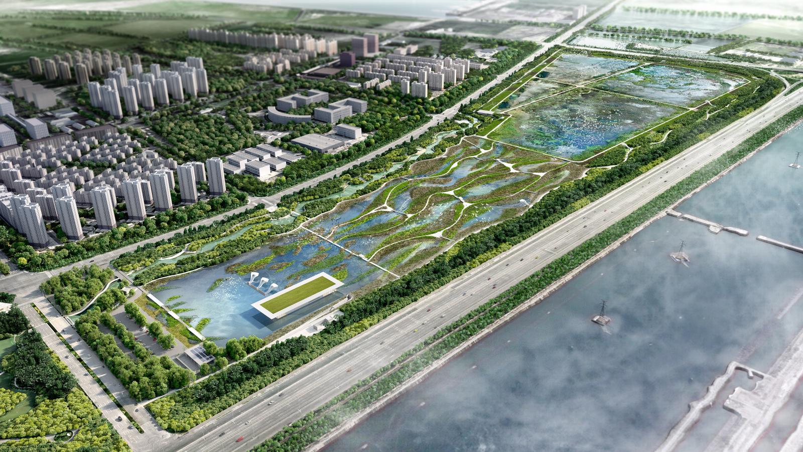
Funded by the Asia Bank and led by the Tianjin Economic-Technological Development Area (TEDA) the Lingang Bird Sanctuary is an ambitious project to deliver a flagship ecological wetland precinct. Located along the key bird migration route known as the East Asian Australasian Flyway the wetland design responds to targeted environmental conditions to attract and offer refuge for several endangered bird species.

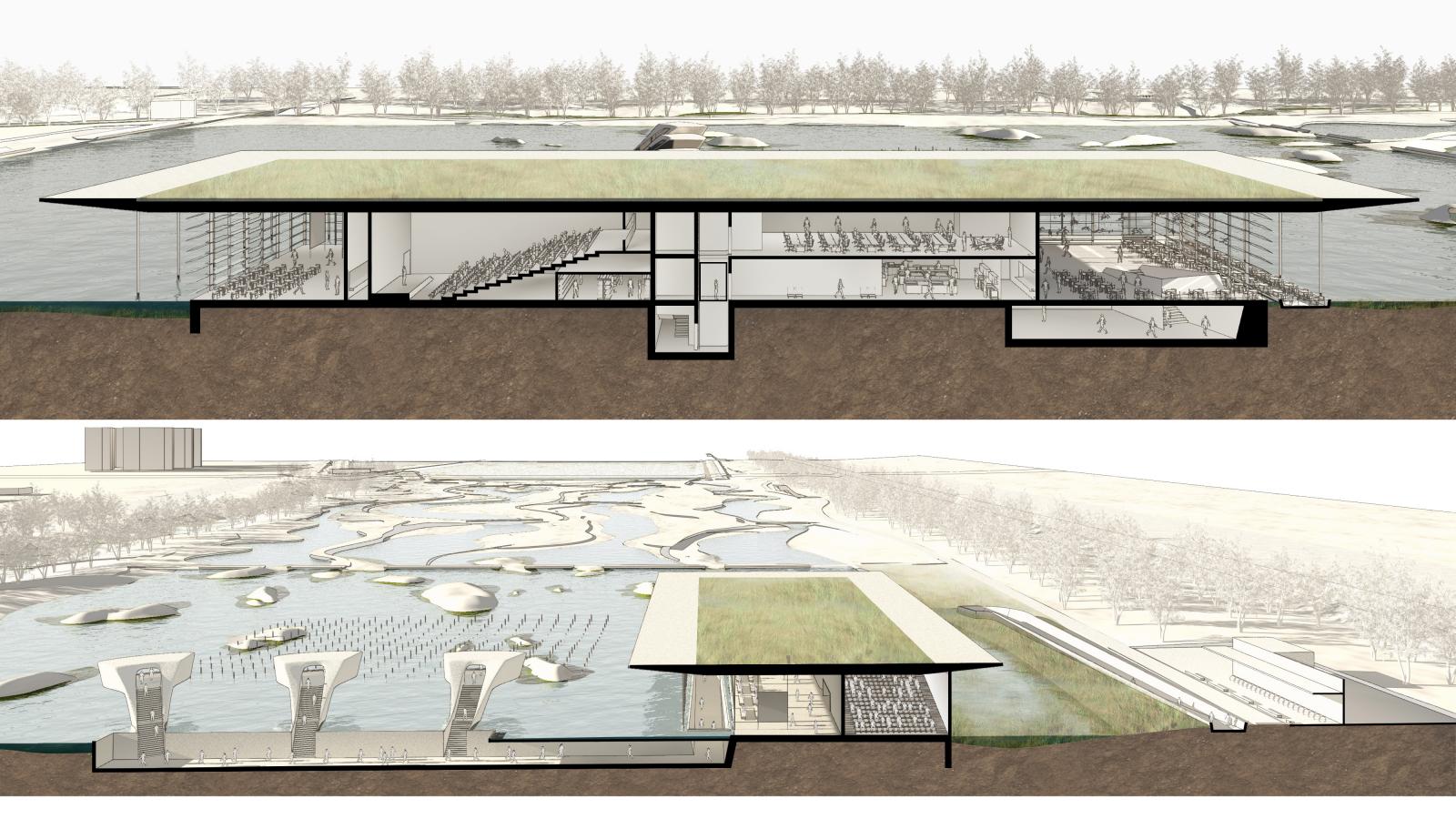
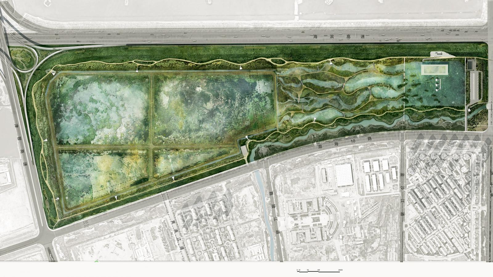
Spanning 61 hectares the landscape has been specifically designed to support the needs of more than fifty species of birds in three different water habitats including an island lake with shallow rapids, reed zone and mud flats. When complete the site will comprise 14 bird hides, a 20-hectare forest and a 3,500m2 visitor and research centre called the Water Pavilion. Other public facilities include Wetland Trails, a Lake Loop Walk, Cycle Circuit and Forest Walk making a 7km network of recreation trails.

Site Area

110 ha

Services

  • Competition
  • Contaminated Sites
  • Industrial
  • Landscape Master Plan
  • Water Sensitive Urban Design [WSUD]
  • Stormwater Harvesting and Reuse
  • Wetland and Lake Design
  • Catchment Planning and Design
  • Catchment Flow Models
  • Cloudburst Design

Collaborators

  • Avifauna Research & Services Pty Ltd
Black and white portrait of Ann Deng, a woman with short dark hair smiling at the camera. She is wearing a short-sleeved, fluffy light-colored sweater and a delicate necklace with a small pendant. She stands against a plain background.
Talk to Ann Deng about Lingang Bird Airport
Get In Touch
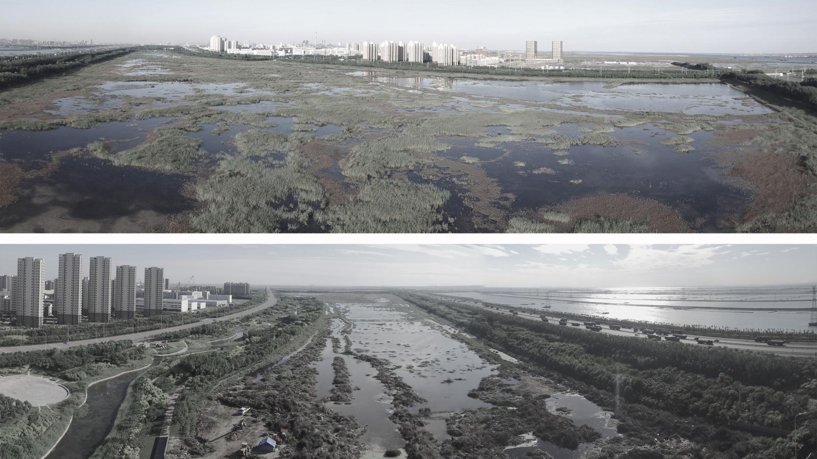
Two panoramic aerial images show a large wetland area near Lingang, adjacent to an urban environment. The landscape is dotted with water channels and vegetation, with high-rise buildings in the background. The top image offers a closer view, and the bottom image provides a wider perspective.
A split-view architectural rendering of a building with a flat, green roof set in a landscaped area surrounded by water at Lingang. The cross-section below shows multiple levels, including open spaces, staircases, and seating areas. Trees and pathways are visible in the background along with bird icons denoting nearby habitats.
Map illustrating migratory bird routes across East Asia, Australia, and beyond, with statistical data in Mandarin and English showing 22 countries involved, 29 protected sites, and 5.1 million birds migrating annually. Inset highlights key regions and sites such as Lingang's renowned Bird Airport.
A top-down view of a vast, rectangular green park in Lingang featuring a central water body, winding pathways, and lush vegetation. To the left are roads leading to the park, with urban buildings and Bird Airport visible on the lower right.
A bustling park path lined with trees and plants. On the right, a futuristic white observation tower with stairs provides an elevated view. People stroll, chat, and ride bikes; children play. Birds fly in the sky above, adding to the lively atmosphere reminiscent of Lingang's vibrant energy.
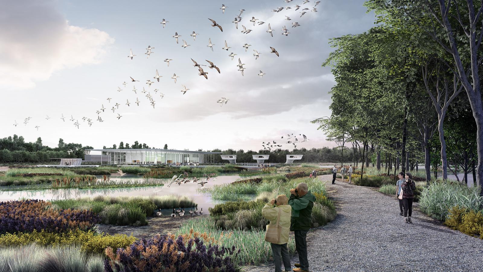
A nature reserve with people walking on a gravel path alongside wetlands. Birds are flying in the sky. Trees and greenery surround the area, with a modern building visible in the background near Lingang. Two people stand closer to the foreground observing the birds.
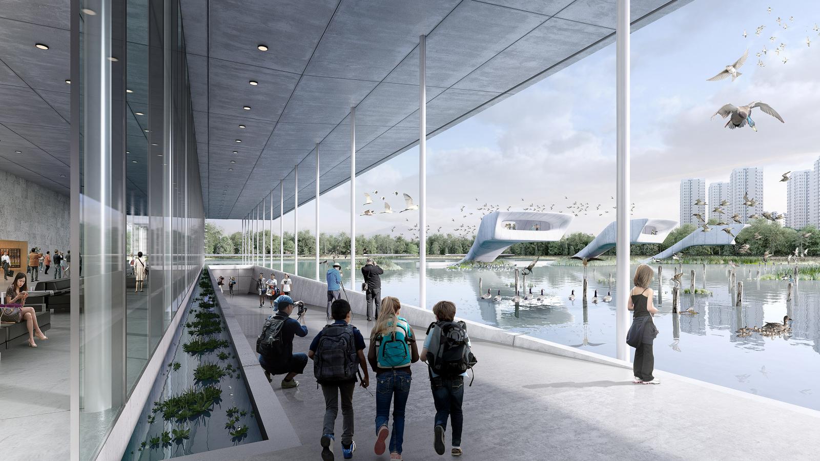
A modern building with large glass windows overlooks a scenic lake. People are walking along the lakeside walkway, and several children with backpacks observe the scenery. Birds from Bird Airport are flying near the water, and tall buildings near Lingang are visible in the background.
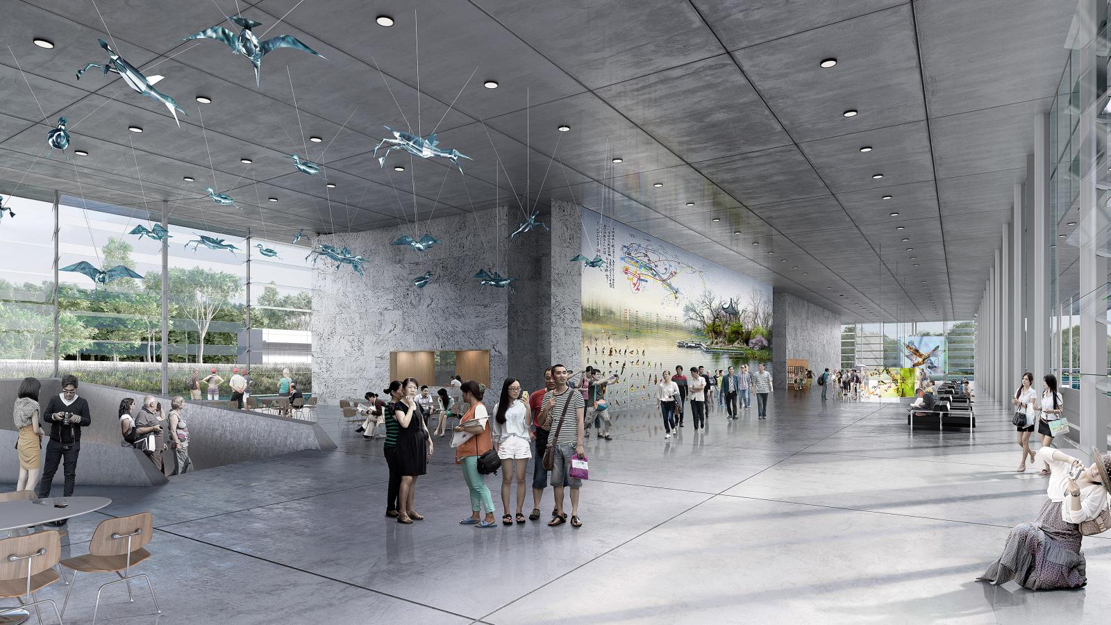
A spacious, modern museum or gallery interior with high ceilings and large windows. People are observing displays, interacting, and walking. Hanging sculptures and art installations adorn the space, with a large mural inspired by Lingang Bird Airport visible on one wall. Trees are visible outside.
Aerial view of a large urban park beside a river in Lingang. The park features multiple ponds, green spaces, and winding pathways. High-rise buildings and residential areas are situated to the left, while a road and Bird Airport are on the right, with recreational areas in between.

More Projects

More Projects